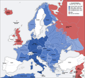
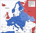
Fayl:Second world war europe 1941-1942 map en.png

Sahifa kontenti boshqa tillarda dastaklanmaydi.
Vikipediya, ochiq ensiklopediya

Asl fayl(1 090 × 1 000 piksel, fayl hajmi: 216 KB, MIME tipi: image/png)

Ushbu fayl Vikiomborga yuklangan boʻlib, boshqa loyihalarda ham qoʻllanilishi mumkin. Uning tavsif sahifasidan olingan maʼlumot quyida keltirilgan.

This military map image could be re-created using vector graphics as an SVG file. This has several advantages; see Commons:Media for cleanup for more information. If an SVG form of this image is available, please upload it and afterwards replace this template with {{vector version available|new image name}}.


It is recommended to name the SVG file “Second world war europe 1941-1942 map en.svg”—then the template Vector version available (or Vva) does not need the new image name parameter.
Maps of the history of Europe
BCE
aC

Weichselian ice age (c. 113,000–9700) · Neolithic expansion (c. 7000–4500) · Middle Neolithic (c. 4500–4000) · Late Neolithic (c. 4000–3000) · Copper Age – Corded Ware culture (c. 2900–2350) · Copper Age – Bellbeaker culture (c. 2800–1800) · Early Bronze Age – Unetice culture (c. 2300–1600) · Late Bronze Age – Urnfield culture (c. 1300—750) · Migrations (c. 1000–100) · Hallstatt & La Tène cultures (c. 800–100) · Roman Republic (510–40) · 220 · 218 · 200 · 201–100 · 58 · 49 · 39 · 30 BCE–6 CE


CE
dC

14 · 14–37 · 60 · 60 · 69 · 80 · Migrations 100–500 · 117 · 117 · 125 · Migrations 150–774 · Economy 180 · 271 · 293–305 · 337 · 395 · c. 395 · 400 · 400 · 450 · 457–61 · 476 · 480 · Franks 481–814 · Early Slavs 500–700 · 500 · 526 · 526–600 · Christianisation to 600 · c. 550 · 650 · Pontic Steppe 650 · 665 · 800 · Vikings 800–1050 · 814 · 843–70 · 850 · 900 · 912 · 998 · 1000 · 1000 · 1054 · 1092 · First Crusade 1095–99 · 1097 · 1135 · 1142 · 1147–49 · 1190 · 1190 · 1250 · c. 1250 · 1301-1400 · 1301-1400 · 1328 · 1345 · Black Plague 1347–51 · 1360 · 1400 · Trade routes c. 1400 · 1430 · 1470 · 1490 · 1492 · 1500 · 1519 · 1550 · 1560 · Religion 1560 · Religion 1600 · Religion 1618 · 1618–48 · 1648 · 1683 · 1700 · 1701 · 1708 · 1714 · 1721 · 1725–30 · 1739–1740 · 1740 · 1748–66 · 1783–1792 · 1787 · 1787 · 1789 · 1799 · 1812 · 1812 · 1812 · 1812 · 1813 · 1815 · 1815 · 1815 · 1818 · Ottoman Empire 1830–1923 · 1848–49 · 1861 · 1867 · 1871 · 1878 · 1890 · 1905 · 1911 · 1914 · 1914 · 1919 · 1919–29 · 1923 · 1929 · 1930 · 1940 · 1941–42 · 1942–45 · Cold War 1947–91 · 1950 · 1993–2006 · 2006 to date

(this template: · view · discuss )

Qisqa izoh

Annotations
InfoField
This image is annotated: View the annotations at Commons
Taʼrif
Deutsch: Karte der vom Deutschen Reich besetzten Gebiete und der Kriegsfronten im Zweiten Weltkrieg, 1941/42.
English: A map of German front of the Second World War circa 1941-1942.
Ελληνικά: Εδαφικές κατακτήσεις του Ράιχ
Español: Conquistas territoriales del Reich
Sanasi Original Image: 17 April 2005
Derivative Image: 22 December 2005
Manba This file was derived from: Second world war europe 1941-1942 map de.png
Muallif Original Author: User:San Jose
Derivative Author: User:ArmadniGeneral
Ruxsat
(Bu faylning takror foydalanilishi)
This image is a translation of the original, created and released under the terms of the GNU Free Documentation License.
Other versions

Derivative works of this file:  Großdeutsches Reich-europe.png [tahrirlash]

Litsenziyalash

GNU head Ushbu hujjatdan nusxa ko‘chirish, tarqatish va/yoki o‘zgartirish uchun GNU Erkin guvohnoma litsenziyasi (GNU Free Documentation License), 1.2 va har qanday keyingi versiyalar shartlariga muvofiq ruxsat berilgan yoki Ochiq kodli dasturlar jamiyati (Free Software Foundation) tomonidan chop etilgan; oʻzgarmas boʻlimlarsiz, oldingi muqova matnlari va orqa muqova matnlarisiz. Litsenziya nusxasi GNU Erkin guvohnoma litsenziyasi (GNU Free Documentation License) boʻlimiga kiritilgan.
w:en:Creative Commons
atribut bir xil ulashish
Bu fayl Creative Commons asosida litsenziyalangan Attribution- Share Alike 3.0 Unported litsenziyasi.
Siz erkinsiz:
  • ulashishga – ishlanmani nusxalash, tarqatish va uzatish
  • remiks qilishga – ishni moslashtirishga
Quyidagi shartlar asosida:
  • atribut – Siz tegishli litsenziyaga havolani taqdim etishingiz va oʻzgartirishlar kiritilganligini koʻrsatishingiz kerak. Siz buni har qanday oqilona yoʻl bilan qilishingiz mumkin, lekin litsenziar Sizni yoki Sizning foydalanishingizni ma'qullashini taklif qiladigan tarzda emas.
  • bir xil ulashish – Agar Siz materialni remiks qilsangiz, oʻzgartirsangiz yoki unga asoslansangiz, oʻz hissalaringizni asl nusxadagi kabi bir xil yoki mos litsenziya ostida tarqatishingiz kerak.
This licensing tag was added to this file as part of the GFDL licensing update.

Captions

Add a one-line explanation of what this file represents

Items portrayed in this file

tasvirlangan ob'ekt

image/png

Fayl tarixi

Faylning biror paytdagi holatini koʻrish uchun tegishli sana/vaqtga bosingiz.

Sana/VaqtMiniaturaOʻlchamlariFoydalanuvchiIzoh
joriy16:20, 5-Avgust 202016:20, 5-Avgust 2020 dagi versiya uchun tasvir1 090 × 1 000 (216 KB)Claude ZygielDistinguished statutes
01:00, 28-Iyul 201801:00, 28-Iyul 2018 dagi versiya uchun tasvir1 090 × 1 000 (184 KB)JeffyPShrinking file size
08:06, 16-Fevral 200908:06, 16-Fevral 2009 dagi versiya uchun tasvir1 090 × 1 000 (214 KB)Guinnog{{Information |Description=better titles |Source=*File:Second_world_war_europe_1941-1942_map_en.png |Date=2009-02-16 08:05 (UTC) |Author=*File:Second_world_war_europe_1941-1942_map_en.png: Sir Lothar *derivative work: ~~~ |Permission=see below
00:22, 11-Aprel 200800:22, 11-Aprel 2008 dagi versiya uchun tasvir1 090 × 1 000 (208 KB)Sir Lothar
05:36, 21-Dekabr 200505:36, 21-Dekabr 2005 dagi versiya uchun tasvir1 090 × 1 000 (221 KB)ArmadniGeneralA map of the Eastern front of the Second World War circa 1941-1942. The original German-language map was created by User:San Jose on 17 April 2005. It can be found here: Image:Second world war europe 1941-1942 map de.png. This image is a translat

Bu faylga quyidagi sahifa bogʻlangan:

Faylning global foydalanilishi

Ushbu fayl quyidagi vikilarda ishlatilyapti:

Ushbu faylni koʻproq global foydalanishdan koʻring.

Metama’lumot