
Fayl:High Rise Living at Deansgate Square, geograph 7187627 by David Dixon.jpg
Bu prevyuning hajmi: 450 × 600 piksel. Boshqa oʻlchamlari: 180 × 240 piksel | 360 × 480 piksel | 768 × 1 024 piksel.
Asl fayl (768 × 1 024 piksel, fayl hajmi: 1,08 MB, MIME tipi: image/jpeg)
Qisqa izoh
| Taʼrif |
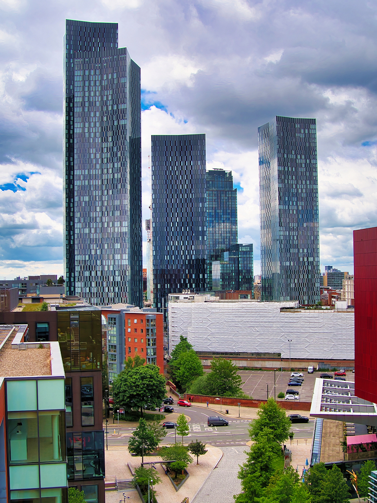
English: The four new tower blocks built around Deansgate Square dominate the skyline in the recently-regenerated area near Deansgate Station. Development of the area began in May 2016, with the four towers being completed in May 2018 (West Tower), November 2018 (South Tower) and August 2019 (North and East Towers). When completed, in 2018, the 64-storey South Tower surpassed the Beetham Tower as the tallest building in Manchester; it is currently the tenth highest in the UK (the tallest outside London). |
||
| Sanasi | |||
| Manba | geograph.org.uk | ||
| Muallif | David Dixon | ||
| Ruxsat (Bu faylning takror foydalanilishi) |
This file is licensed under the Creative Commons Attribution-Share Alike 2.0 Generic license. Attributsiya: David Dixon
|
||
| Attributsiya (required by the license) | David Dixon / High Rise Living at Deansgate Square / | ||

| Camera location | | View this and other nearby images on: OpenStreetMap |
|---|
_region:GB-EAW_heading:270.00&language=uz)
| Object location | | View this and other nearby images on: OpenStreetMap |
|---|
_region:GB-EAW_heading:270.00&language=uz)
Fayl tarixi
Faylning biror paytdagi holatini koʻrish uchun tegishli sana/vaqtga bosingiz.
| Sana/Vaqt | Miniatura | Oʻlchamlari | Foydalanuvchi | Izoh | |
|---|---|---|---|---|---|
| joriy | 07:39, 8-Aprel 2023 | | 768 × 1 024 (1,08 MB) | G-13114 | {{Information |description={{en|1=The four new tower blocks built around Deansgate Square dominate the skyline in the recently-regenerated area near Deansgate Station. Development of the area began in May 2016, with the four towers being completed in May 2018 (West Tower), November 2018 (South Tower) and August 2019 (North and East Towers). When completed, in 2018, the 64-storey South Tower surpassed the Beetham Tower as the tallest building in Manchester; it is currently the tenth highest i... |
Fayllarga ishoratlar
Bu faylga quyidagi sahifa bogʻlangan:
Faylning global foydalanilishi
Ushbu fayl quyidagi vikilarda ishlatilyapti:
- en.wikipedia.org loyihasida foydalanilishi
- sl.wikipedia.org loyihasida foydalanilishi