
Fayl:Zuid-Holland position.svg

Size of this PNG preview of this SVG file: 200 × 236 piksel. Boshqa oʻlchamlari: 203 × 240 piksel | 407 × 480 piksel | 651 × 768 piksel | 868 × 1 024 piksel | 1 736 × 2 048 piksel.
Asl fayl (SVG fayl, asl oʻlchamlari 200 × 236 piksel, fayl hajmi: 158 KB)
Qisqa izoh
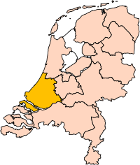
| Taʼrif | Location of the province of South-Holland (South Holland) in the Netherlands. |
| Sanasi | |
| Manba | Own work, based on freely available GIS data |
| Muallif | User:Mtcv |
| Ruxsat (Bu faylning takror foydalanilishi) |
Data: attribution required; my work: PD |
| Other versions | I attempted to make an svg version of Image:Zuid Holland-Position.png (with less simplified boundaries) |
Clickable version

Litsenziyalash

|
The copyright holder of this file, Centraal Bureau voor de Statistiek, allows anyone to use it for any purpose, provided that the copyright holder is properly attributed. Redistribution, derivative work, commercial use, and all other use is permitted. |
Attributsiya:
|
| Annotations | This image is annotated: View the annotations at Commons |


Fayl tarixi
Faylning biror paytdagi holatini koʻrish uchun tegishli sana/vaqtga bosingiz.
| Sana/Vaqt | Miniatura | Oʻlchamlari | Foydalanuvchi | Izoh | |
|---|---|---|---|---|---|
| joriy | 17:21, 2-Mart 2019 | | 200 × 236 (158 KB) | Thayts | update |
| 00:49, 3-Oktyabr 2006 |  | 200 × 236 (158 KB) | Mtcv | {{Information| |Description=Location of the province of Noord-Holland (North Holland) in the Netherlands. |Source=Own work, based on freely available GIS data |Date=2006-10-03 |Author=User:Mtcv |Permission=Data: attribution required; my work: PD |othe |
Fayllarga ishoratlar
Bu faylga quyidagi sahifa bogʻlangan:
Faylning global foydalanilishi
Ushbu fayl quyidagi vikilarda ishlatilyapti:
- ar.wikipedia.org loyihasida foydalanilishi
- روتردام
- لاهاي
- جنوب هولندا
- لايدن
- دلفت
- خاودا
- زوترمير
- سخيدام
- قالب:بلديات جنوب هولندا
- خوريكوم
- خوريه- أوفرفلاكيه
- كاتفايك
- ماسلاوس
- فلاردينجن
- دوردريخت
- ليسه
- ألبلاسردام
- ألبراندزفارد
- ألفن آن دن راين
- باريندريخت
- كرمبنيرفارد
- نيسافارد
- بيننيماس
- بوديخرافن-ريودايك
- بريله
- كابيلا آن دن آيسل
- كرومستراين
- خيسينلاندن
- هاردينكسفيلد- خيسيندام
- هيليفوتسلاوس
- هندريك- إيدو- أمباخت
- هيليخوم
- كاخ آن براسم
- كوريندايك
- كريمبن آن دن آيسل
- لانسينجيرلاند
- ليردام
- لايدردورب
- لايتسيندام- فوربورخ
- ميدن- دلفلاند
- مولنفارد
- نيوكوب
- نوردفايك
- نوردفايكرهاوت
- أوخستخيست
- آود- بايرلاند
- آودركيرك
- بابندريخت
- باين آكر- نوتدورب
- ريدركيرك
Ushbu faylni koʻproq global foydalanishdan koʻring.