
Fayl:Usa edcp (+HI +AK) location map.svg

Size of this PNG preview of this SVG file: 800 × 495 piksel. Boshqa oʻlchamlari: 320 × 198 piksel | 640 × 396 piksel | 1 024 × 634 piksel | 1 280 × 792 piksel | 2 560 × 1 585 piksel | 1 181 × 731 piksel.
Asl fayl (SVG fayl, asl oʻlchamlari 1 181 × 731 piksel, fayl hajmi: 3,68 MB)
Qisqa izoh
| Taʼrif |
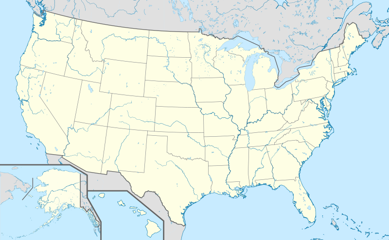
English: Location map of the USA (Hawaii and Alaska shown in sidemaps).
Main map: EquiDistantConicProjection : Central parallel : * N: 37.0° N Central meridian : * E: 96.0° W Standard parallels: * 1: 32.0° N * 2: 42.0° N Made with Natural Earth. Free vector and raster map data @ naturalearthdata.com. Formulas for x and y: x = 50.0 + 124.03149777329222 * ((1.9694462586094064-({{{2}}}* pi / 180))
* sin(0.6010514667026994 * ({{{3}}} + 96) * pi / 180))
y = 50.0 + 1.6155950752393982 * 124.03149777329222 * 0.02613325650382181
- 1.6155950752393982 * 124.03149777329222 *
(1.3236744353715044 - (1.9694462586094064-({{{2}}}* pi / 180))
* cos(0.6010514667026994 * ({{{3}}} + 96) * pi / 180))
Hawaii side map: Equirectangular projection, N/S stretching 107 %. Geographic limits of the map:
Alaska side map: Equirectangular projection, N/S stretching 210.0 %. Geographic limits of the map:
|
| Sanasi | |
| Manba |
Oʻzimning ishim This vector image includes elements that have been taken or adapted from this file: This vector image includes elements that have been taken or adapted from this file: This vector image includes elements that have been taken or adapted from this file: This vector image includes elements that have been taken or adapted from this file: This vector image includes elements that have been taken or adapted from this file: This vector image includes elements that have been taken or adapted from this file: |
| Muallif |
TUBS |
| Other versions |
|
| SVG genesis |
_location_map.svg)
_relief_location_map.png)
_relief_location_map.svg)
_location_map.svg)
Litsenziyalash
I, the copyright holder of this work, hereby publish it under the following license:
Bu fayl Creative Commons asosida litsenziyalangan Attribution- Share Alike 3.0 Unported litsenziyasi.
- Siz erkinsiz:
- ulashishga – ishlanmani nusxalash, tarqatish va uzatish
- remiks qilishga – ishni moslashtirishga
- Quyidagi shartlar asosida:
- atribut – Siz tegishli litsenziyaga havolani taqdim etishingiz va oʻzgartirishlar kiritilganligini koʻrsatishingiz kerak. Siz buni har qanday oqilona yoʻl bilan qilishingiz mumkin, lekin litsenziar Sizni yoki Sizning foydalanishingizni ma'qullashini taklif qiladigan tarzda emas.
- bir xil ulashish – Agar Siz materialni remiks qilsangiz, oʻzgartirsangiz yoki unga asoslansangiz, oʻz hissalaringizni asl nusxadagi kabi bir xil yoki mos litsenziya ostida tarqatishingiz kerak.
Fayl tarixi
Faylning biror paytdagi holatini koʻrish uchun tegishli sana/vaqtga bosingiz.
| Sana/Vaqt | Miniatura | Oʻlchamlari | Foydalanuvchi | Izoh | |
|---|---|---|---|---|---|
| joriy | 10:32, 15-Mart 2019 | | 1 181 × 731 (3,68 MB) | Lasunncty | remove unused elements and fix SVG errors |
| 17:03, 24-Oktyabr 2013 |  | 1 181 × 731 (6,93 MB) | TUBS | ||
| 16:27, 24-Oktyabr 2013 |  | 1 181 × 731 (6,94 MB) | TUBS | ||
| 15:52, 24-Oktyabr 2013 |  | 1 181 × 731 (3,73 MB) | TUBS | ||
| 15:38, 24-Oktyabr 2013 |  | 1 181 × 731 (3,73 MB) | TUBS | ||
| 15:25, 24-Oktyabr 2013 |  | 1 181 × 731 (3,73 MB) | TUBS | == Summary == {{Information |Description={{en|1=Location map of the USA (Hawaii and Alaska shown in sidemaps). ===Main Map Projection=== EquiDistantConicProjection : Central parallel : * N: 37.0° N Central meridian : * E: 96.0° W Standard parallel... |
Fayllarga ishoratlar
Bu faylga quyidagi 2 sahifalar bogʻlangan:
Faylning global foydalanilishi
Ushbu fayl quyidagi vikilarda ishlatilyapti:
- als.wikipedia.org loyihasida foydalanilishi
- San Marino (Kalifornien)
- Modesto
- Karlsruhe (Nord Dakota)
- Fargo
- Vorlage:Positionskarte USA
- St. Louis
- Philadelphia
- Norwood (Missouri)
- Wind Gap (Pennsylvania)
- Park City (Kentucky)
- Berne (Indiana)
- Vorlage:Infobox NRHP
- Vorlage:Positionskarte USA Texas
- Vorlage:Positionskarte USA Wisconsin
- Vorlage:Positionskarte USA Maryland
- Vorlage:Positionskarte USA New York
- Vorlage:Positionskarte USA New York City
- Vorlage:Positionskarte USA New York City Manhattan
- de.wikipedia.org loyihasida foydalanilishi
- Hollywood
- Los Angeles
- San Francisco
- Wyoming
- Houston
- Boston
- Cape Canaveral (Küstenabschnitt)
- Seattle
- Grand Canyon
- Philadelphia
- Crazy Horse Memorial
- Phoenix (Arizona)
- Yellowstone-Nationalpark
- Arches-Nationalpark
- Badlands-Nationalpark
- Big-Bend-Nationalpark
- Biscayne-Nationalpark
- Bryce-Canyon-Nationalpark
- Canyonlands-Nationalpark
- Acadia-Nationalpark
- Black-Canyon-of-the-Gunnison-Nationalpark
- Carlsbad-Caverns-Nationalpark
- Channel-Islands-Nationalpark
- Miami
- Everglades-Nationalpark
- Glacier-Nationalpark (Vereinigte Staaten)
- Grand-Teton-Nationalpark
- Great-Basin-Nationalpark
- Isle-Royale-Nationalpark
- Joshua-Tree-Nationalpark
- Mount St. Helens
- Lassen-Volcanic-Nationalpark
Ushbu faylni koʻproq global foydalanishdan koʻring.
_location_map.svg)
_location_map.svg)