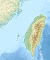
Fayl:Taiwan relief location map.jpg

Bu prevyuning hajmi: 498 × 599 piksel. Boshqa oʻlchamlari: 199 × 240 piksel | 399 × 480 piksel | 1 016 × 1 222 piksel.
Asl fayl (1 016 × 1 222 piksel, fayl hajmi: 101 KB, MIME tipi: image/jpeg)
Fayl tarixi
Faylning biror paytdagi holatini koʻrish uchun tegishli sana/vaqtga bosingiz.
| Sana/Vaqt | Miniatura | Oʻlchamlari | Foydalanuvchi | Izoh | |
|---|---|---|---|---|---|
| joriy | 14:01, 19-Sentyabr 2019 |  | 1 016 × 1 222 (101 KB) | Geographyinitiative | temporary fix: extending the boundary out around Dongyin Township (as in China Fujian2 location map.svg and as in File:Nationalist China - administrative divisons. LOC 2007633622.jpg) |
| 17:09, 3-Avgust 2019 |  | 1 016 × 1 222 (537 KB) | NordNordWest | border corrections | |
| 01:51, 3-Avgust 2019 |  | 1 016 × 1 222 (96 KB) | Geographyinitiative | Proposed removal of three dashes (markers of the approximate PRC/ROC maritime boundary) which seemed to put Dadan Island, Erdan Island and Binlang Islet (檳榔嶼) outside the territory of Kinmen County, Taiwan/ROC. This is not the optimal form of the map, but is merely a quick removal of incorrect information. In the optimal situation, the line needs to be redrawn in the correct location, but I don't have the technical skill to produce such a map. (Basis: [http://ws.mac.gov.tw/001/Upload/OldFile/... | |
| 00:30, 3-Avgust 2019 |  | 1 016 × 1 222 (96 KB) | Geographyinitiative | Proposed removal of two dashes (markers of the approximate PRC/ROC maritime boundary) which seemed to put {{w|Dadan Island}} and {{w|Erdan Island}} outside the territory of {{w|Kinmen County}}, Taiwan/ROC. | |
| 17:22, 28-Dekabr 2010 |  | 1 016 × 1 222 (452 KB) | Uwe Dedering | {{Information |Description={{en|1=Relief location map of Taiwan. * Projection: Equirectangular projection, strechted by 110.0%. * Geographic limits of the map: :* N: 26.4° N :* S: 21.7° N :* W: 118.0° E :* E: 122.3° E * GMT projection: -JX17.204266666 |
Fayllarga ishoratlar
Bu faylga quyidagi 3 sahifalar bogʻlangan:
Faylning global foydalanilishi
Ushbu fayl quyidagi vikilarda ishlatilyapti:
- ar.wikipedia.org loyihasida foydalanilishi
- ast.wikipedia.org loyihasida foydalanilishi
- az.wikipedia.org loyihasida foydalanilishi
- ba.wikipedia.org loyihasida foydalanilishi
- bcl.wikipedia.org loyihasida foydalanilishi
- be.wikipedia.org loyihasida foydalanilishi
- bn.wikipedia.org loyihasida foydalanilishi
- bs.wikipedia.org loyihasida foydalanilishi
- ceb.wikipedia.org loyihasida foydalanilishi
- ce.wikipedia.org loyihasida foydalanilishi
- ckb.wikipedia.org loyihasida foydalanilishi
- de.wikipedia.org loyihasida foydalanilishi
- de.wikivoyage.org loyihasida foydalanilishi
Ushbu faylni koʻproq global foydalanishdan koʻring.


