
Fayl:South Ossetia location map.svg

Size of this PNG preview of this SVG file: 600 × 531 piksel. Boshqa oʻlchamlari: 271 × 240 piksel | 542 × 480 piksel | 868 × 768 piksel | 1 157 × 1 024 piksel | 2 314 × 2 048 piksel.
Asl fayl (SVG fayl, asl oʻlchamlari 600 × 531 piksel, fayl hajmi: 140 KB)
Qisqa izoh
| Taʼrif |
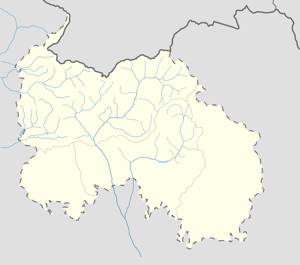
English: Location map of South Ossetia
Geographic limits of the map:
Ирон: Хуссар Ирыстоны позицион картæ
Кæрæтты координæттæ:
|
| Sanasi | |
| Manba | Oʻzimning ishim |
| Muallif | Soslanx |
| Other versions | File:RSOLocatorMap.png |
Litsenziyalash
| I, the copyright holder of this work, release this work into the public domain. This applies worldwide. In some countries this may not be legally possible; if so: I grant anyone the right to use this work for any purpose, without any conditions, unless such conditions are required by law. |
Fayl tarixi
Faylning biror paytdagi holatini koʻrish uchun tegishli sana/vaqtga bosingiz.
| Sana/Vaqt | Miniatura | Oʻlchamlari | Foydalanuvchi | Izoh | |
|---|---|---|---|---|---|
| joriy | 10:05, 7-Dekabr 2016 | | 600 × 531 (140 KB) | Giorgi Balakhadze | Rv of sockpuppet |
| 00:10, 15-Fevral 2015 |  | 600 × 531 (140 KB) | Leftcry | Reverted to version as of 15:04, 4 September 2011 That doesn't really "fix" anything | |
| 18:21, 14-Fevral 2015 |  | 600 × 531 (140 KB) | Giorgi Balakhadze | Fixing border | |
| 15:04, 4-Sentyabr 2011 |  | 600 × 531 (140 KB) | Bouron | Black sea basin rivers added | |
| 16:20, 27-Mart 2011 |  | 600 × 531 (118 KB) | Bouron | hydro reloading: + basin of L.Liakhva rivers width fixed | |
| 17:19, 25-Mart 2011 |  | 600 × 531 (104 KB) | Bouron | Hydro reloading: bassin of Bigger Liakhva river added | |
| 10:40, 17-Fevral 2011 |  | 600 × 531 (83 KB) | Iguacu | dotted-lined borders of SO | |
| 18:06, 16-Fevral 2011 |  | 600 × 531 (98 KB) | Bouron | border fixed | |
| 12:59, 15-Fevral 2011 |  | 1 006 × 910 (73 KB) | Bouron | Reverted to version as of 12:51, 13 June 2010 | |
| 12:40, 15-Fevral 2011 |  | 5 785 × 5 203 (77 KB) | Bouron | Reverted to version as of 12:09, 13 June 2010 |
Fayllarga ishoratlar
Bu faylga quyidagi 2 sahifalar bogʻlangan:
Faylning global foydalanilishi
Ushbu fayl quyidagi vikilarda ishlatilyapti:
- af.wikipedia.org loyihasida foydalanilishi
- ar.wikipedia.org loyihasida foydalanilishi
- az.wikipedia.org loyihasida foydalanilishi
- ba.wikipedia.org loyihasida foydalanilishi
- be.wikipedia.org loyihasida foydalanilishi
- bg.wikipedia.org loyihasida foydalanilishi
- bn.wikipedia.org loyihasida foydalanilishi
- bs.wikipedia.org loyihasida foydalanilishi
- ceb.wikipedia.org loyihasida foydalanilishi
- ce.wikipedia.org loyihasida foydalanilishi
- ckb.wikipedia.org loyihasida foydalanilishi
- cs.wikipedia.org loyihasida foydalanilishi
- da.wikipedia.org loyihasida foydalanilishi
- de.wikipedia.org loyihasida foydalanilishi
- en.wikipedia.org loyihasida foydalanilishi
Ushbu faylni koʻproq global foydalanishdan koʻring.