
Fayl:Ruanda 2007 de.svg

Asl fayl (SVG fayl, asl oʻlchamlari 981 × 729 piksel, fayl hajmi: 246 KB)
Qisqa izoh
| Taʼrif |
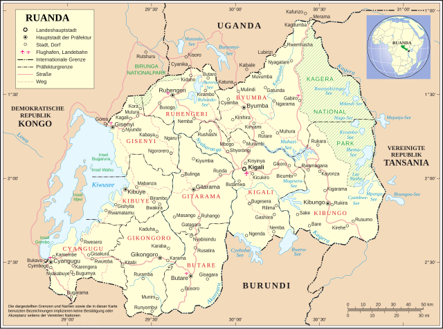
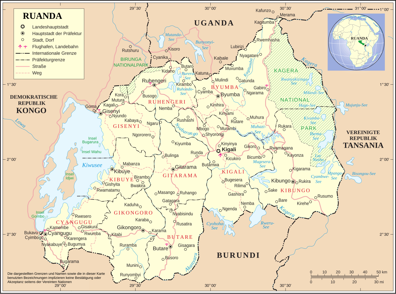
Deutsch: Karte Ruandas nach Verwaltungsreform im Jahr 2006
English: Map of Rwanda after administrative reform of 2006 (german) |
|||
| Sanasi | ||||
| Manba | Image:Un-rwanda.png http://www.un.org/Depts/Cartographic/english/htmain.htm | |||
| Muallif | Image:Ruanda deutsch UNO-Karte.jpg + UN Original changed to SVG + new province | |||
| Ruxsat (Bu faylning takror foydalanilishi) |
|
|||
| Other versions |
|
|||
| SVG genesis |


Fayl tarixi
Faylning biror paytdagi holatini koʻrish uchun tegishli sana/vaqtga bosingiz.
| Sana/Vaqt | Miniatura | Oʻlchamlari | Foydalanuvchi | Izoh | |
|---|---|---|---|---|---|
| joriy | 22:01, 23-Sentyabr 2018 | | 981 × 729 (246 KB) | JoKalliauer | corrected marings |
| 00:20, 12-Avgust 2018 |  | 981 × 729 (432 KB) | Furfur | Kiwusee | |
| 05:56, 1-Aprel 2016 |  | 967 × 716 (433 KB) | Wereldburger758 | Scale raised to the layer above. Removed border. No librsvg error detected. Validation of image. | |
| 12:52, 26-Iyun 2009 |  | 990 × 765 (450 KB) | FischX | fix | |
| 12:47, 26-Iyun 2009 |  | 990 × 765 (451 KB) | FischX | fix | |
| 12:40, 26-Iyun 2009 |  | 990 × 765 (450 KB) | FischX | fix2 | |
| 12:22, 26-Iyun 2009 |  | 990 × 765 (705 KB) | FischX | fix | |
| 09:24, 9-Fevral 2009 |  | 990 × 765 (730 KB) | Martin H. | Reverted to version as of 00:57, 26 February 2008, not better, looks awful in the total view | |
| 09:21, 9-Fevral 2009 |  | 990 × 765 (574 KB) | Martin H. | Reverted to version as of 21:47, 25 February 2008, looks awful in miniature in IE and Firefox, city names are all on the left side | |
| 00:57, 26-Fevral 2008 |  | 990 × 765 (730 KB) | FischX | +Topic Layer |
Fayllarga ishoratlar
Bu faylga quyidagi sahifa bogʻlangan:
Faylning global foydalanilishi
Ushbu fayl quyidagi vikilarda ishlatilyapti:
- nds.wikipedia.org loyihasida foydalanilishi