
Fayl:Prague districts.svg

Size of this PNG preview of this SVG file: 800 × 600 piksel. Boshqa oʻlchamlari: 320 × 240 piksel | 640 × 480 piksel | 1 024 × 768 piksel | 1 280 × 960 piksel | 2 560 × 1 920 piksel.
Asl fayl (SVG fayl, asl oʻlchamlari 1 024 × 768 piksel, fayl hajmi: 1,09 MB)
Qisqa izoh
| Taʼrif |
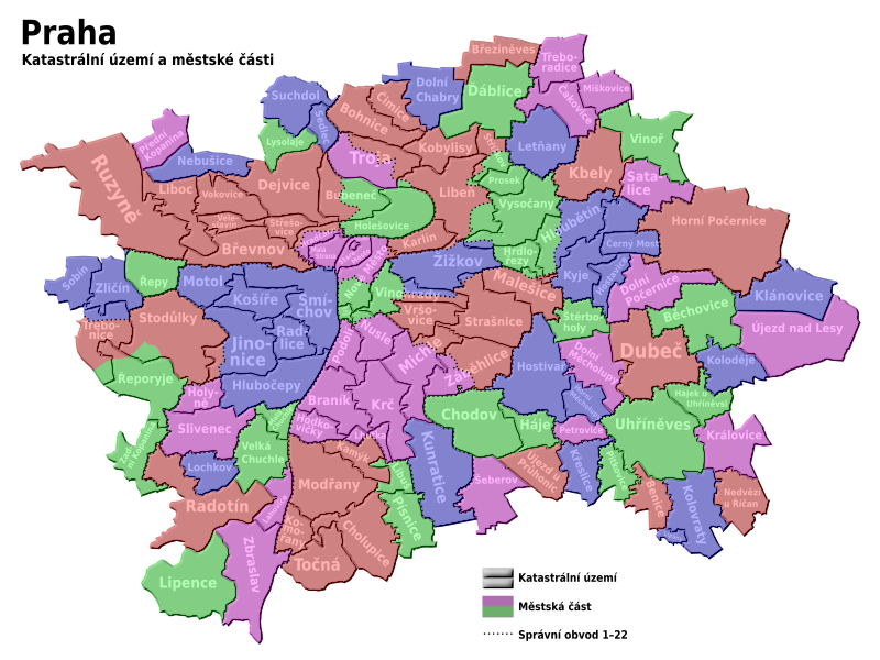
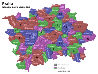
English: Maps of Prague cadastre and administratice districts
Čeština: Mapa pražských katastrálních území a městských částí |
| Sanasi | |
| Manba | Oʻzimning ishim |
| Muallif | Kubiik |
| Other versions | Derivative works of this file: Prague districts en.svg |
This W3C-unspecified vector image was created with Inkscape .
Litsenziyalash
I, the copyright holder of this work, hereby publish it under the following licenses:
Bu fayl Creative Commons asosida litsenziyalangan Attribution- Share Alike 3.0 Unported litsenziyasi.
- Siz erkinsiz:
- ulashishga – ishlanmani nusxalash, tarqatish va uzatish
- remiks qilishga – ishni moslashtirishga
- Quyidagi shartlar asosida:
- atribut – Siz tegishli litsenziyaga havolani taqdim etishingiz va oʻzgartirishlar kiritilganligini koʻrsatishingiz kerak. Siz buni har qanday oqilona yoʻl bilan qilishingiz mumkin, lekin litsenziar Sizni yoki Sizning foydalanishingizni ma'qullashini taklif qiladigan tarzda emas.
- bir xil ulashish – Agar Siz materialni remiks qilsangiz, oʻzgartirsangiz yoki unga asoslansangiz, oʻz hissalaringizni asl nusxadagi kabi bir xil yoki mos litsenziya ostida tarqatishingiz kerak.

|
Ushbu hujjatdan nusxa ko‘chirish, tarqatish va/yoki o‘zgartirish uchun GNU Erkin guvohnoma litsenziyasi (GNU Free Documentation License), 1.2 va har qanday keyingi versiyalar shartlariga muvofiq ruxsat berilgan yoki Ochiq kodli dasturlar jamiyati (Free Software Foundation) tomonidan chop etilgan; oʻzgarmas boʻlimlarsiz, oldingi muqova matnlari va orqa muqova matnlarisiz. Litsenziya nusxasi GNU Erkin guvohnoma litsenziyasi (GNU Free Documentation License) boʻlimiga kiritilgan. |
Siz oʻzingiz xohlagan litsenziyani tanlashingiz mumkin.
Fayl tarixi
Faylning biror paytdagi holatini koʻrish uchun tegishli sana/vaqtga bosingiz.
| Sana/Vaqt | Miniatura | Oʻlchamlari | Foydalanuvchi | Izoh | |
|---|---|---|---|---|---|
| joriy | 18:29, 8-Iyun 2021 | | 1 024 × 768 (1,09 MB) | Martin Tauchman | File uploaded using svgtranslate tool (https://svgtranslate.toolforge.org/). Added translation for cs. |
| 18:24, 8-Iyun 2021 |  | 1 024 × 768 (1,08 MB) | Martin Tauchman | File uploaded using svgtranslate tool (https://svgtranslate.toolforge.org/). Added translation for de. | |
| 12:09, 9-May 2009 |  | 1 024 × 768 (1 002 KB) | Kubiik | Troja is separated part | |
| 09:37, 9-Mart 2009 |  | 1 024 × 768 (1 002 KB) | Kubiik | More accurate and shadow borders | |
| 12:37, 5-Fevral 2009 |  | 1 313 × 990 (884 KB) | Kubiik | {{Information |Description={{en|1=Maps of Prague cadastre and administratice districts}} {{cs|1=Mapa pražských katastrálních území a městských částí}} |Source=Own work by uploader |Author=Kubiik |Date=2009-02-01 |Permission= |ot |
Fayllarga ishoratlar
Bu faylga bogʻlangan sahifalar yoʻq.
Faylning global foydalanilishi
Ushbu fayl quyidagi vikilarda ishlatilyapti:
- bs.wikipedia.org loyihasida foydalanilishi
- cs.wikipedia.org loyihasida foydalanilishi
- cs.wikiversity.org loyihasida foydalanilishi
- de.wikipedia.org loyihasida foydalanilishi
- it.wikipedia.org loyihasida foydalanilishi
- ru.wikipedia.org loyihasida foydalanilishi