
Fayl:Paris department land cover location map.svg

Size of this PNG preview of this SVG file: 800 × 521 piksel. Boshqa oʻlchamlari: 320 × 208 piksel | 640 × 417 piksel | 1 024 × 667 piksel | 1 280 × 834 piksel | 2 560 × 1 667 piksel | 1 371 × 893 piksel.
Asl fayl (SVG fayl, asl oʻlchamlari 1 371 × 893 piksel, fayl hajmi: 6,75 MB)
Qisqa izoh
| Nomi |
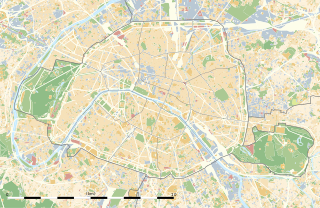
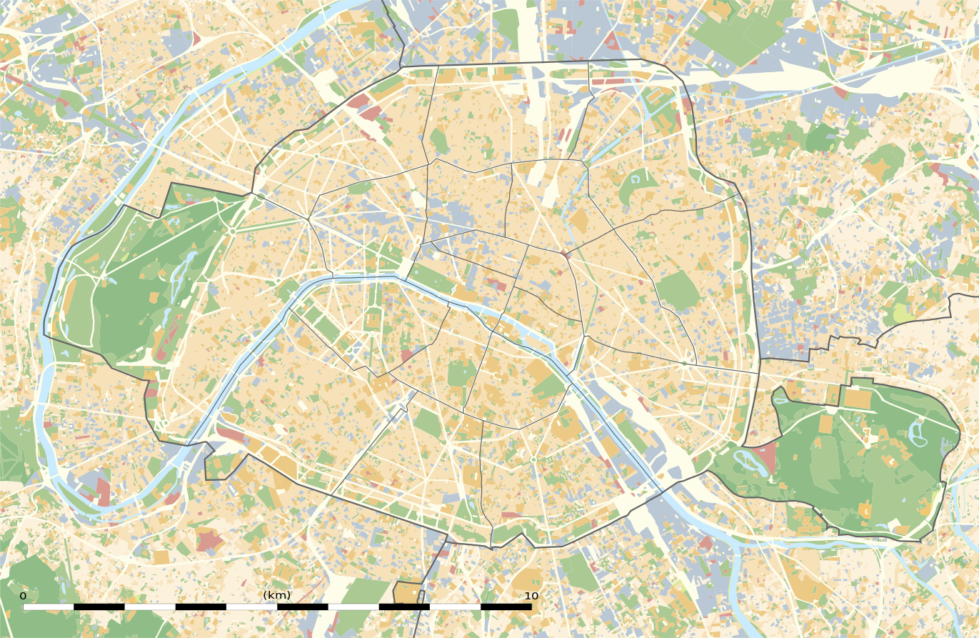
Blank land cover map of the city and department of Paris, France |
||||||||||||||||||||||||||||||||||||
| Description |
English: Blank land cover map of the city and department of Paris, France, as in January 2012, for geo-location purpose, with distinct boundaries for departments and arrondissements.
Français : Carte vierge de l'occupation du sol de la ville et département de Paris, France, tel qu'en janvier 2012, destinée à la géolocalisation, avec limite distincte des départements et arrondissements. |
||||||||||||||||||||||||||||||||||||
| Map legend |
|
||||||||||||||||||||||||||||||||||||
| Sanasi | |||||||||||||||||||||||||||||||||||||
| Manba |
Oʻzimning ishim
|
||||||||||||||||||||||||||||||||||||
| Yaratuvchi | |||||||||||||||||||||||||||||||||||||
| Ruxsat (Bu faylning takror foydalanilishi) |
|
||||||||||||||||||||||||||||||||||||
| Geotemporal data | |||||||||||||||||||||||||||||||||||||
| Date depicted | |||||||||||||||||||||||||||||||||||||
| Map location | Parij 48°51′24″N 2°21′03″E / 48.8567°N 2.3508°E | ||||||||||||||||||||||||||||||||||||
| Spatial reference system | WGS84 datum | ||||||||||||||||||||||||||||||||||||
| Scale | 1:124,000 (precision: 31 m) | ||||||||||||||||||||||||||||||||||||
| Heading |
 |
||||||||||||||||||||||||||||||||||||
| Bounding box |
|
||||||||||||||||||||||||||||||||||||
| Georeferencing | If inappropriate please set warp_status = skip to hide. | ||||||||||||||||||||||||||||||||||||
| Other versions |
|
||||||||||||||||||||||||||||||||||||


Litsenziyalash
Eric Gaba, Wikimedia Commons user Sting, the copyright holder of this work, hereby publishes it under the following license:
Bu fayl Creative Commons asosida litsenziyalangan Attribution- Share Alike 3.0 Unported litsenziyasi.
Attributsiya: Eric Gaba, Wikimedia Commons user Sting
- Siz erkinsiz:
- ulashishga – ishlanmani nusxalash, tarqatish va uzatish
- remiks qilishga – ishni moslashtirishga
- Quyidagi shartlar asosida:
- atribut – Siz tegishli litsenziyaga havolani taqdim etishingiz va oʻzgartirishlar kiritilganligini koʻrsatishingiz kerak. Siz buni har qanday oqilona yoʻl bilan qilishingiz mumkin, lekin litsenziar Sizni yoki Sizning foydalanishingizni ma'qullashini taklif qiladigan tarzda emas.
- bir xil ulashish – Agar Siz materialni remiks qilsangiz, oʻzgartirsangiz yoki unga asoslansangiz, oʻz hissalaringizni asl nusxadagi kabi bir xil yoki mos litsenziya ostida tarqatishingiz kerak.
Fayl tarixi
Faylning biror paytdagi holatini koʻrish uchun tegishli sana/vaqtga bosingiz.
| Sana/Vaqt | Miniatura | Oʻlchamlari | Foydalanuvchi | Izoh | |
|---|---|---|---|---|---|
| joriy | 02:18, 12-Fevral 2015 | | 1 371 × 893 (6,75 MB) | Sting | == {{int:filedesc}} == {{Location|48|51|22.5|N|02|20|37.5|E|scale:50000}} {{Information |Description={{en|Blank land cover map of the city and department of Paris, France, as in January 2012, for geo-location purpose, with distinct bounda... |
Fayllarga ishoratlar
Bu faylga quyidagi 4 sahifalar bogʻlangan:
Faylning global foydalanilishi
Ushbu fayl quyidagi vikilarda ishlatilyapti:
- als.wikipedia.org loyihasida foydalanilishi
- ar.wikipedia.org loyihasida foydalanilishi
- ast.wikipedia.org loyihasida foydalanilishi
- azb.wikipedia.org loyihasida foydalanilishi
- az.wikipedia.org loyihasida foydalanilishi
- be.wikipedia.org loyihasida foydalanilishi
- bg.wikipedia.org loyihasida foydalanilishi
- Бастилия
- Отьой
- Дефанс
- Пер Лашез
- Халите (Париж)
- Музей Орсе
- Монмартър
- Университет „Париж-VI: Пиер и Мария Кюри“
- Университет Париж-I Пантеон-Сорбона
- Университет Париж-VII: Дени Дидро
- Университет Пари-Дофин
- Национална библиотека на Франция
- Александър III (мост)
- Ил дьо ла Сите
- Монпарнас
- Маре (Париж)
- Жусийо (кампус)
- Музей на изкуството и историята на юдаизма
- Шаблон:ПК Франция Париж
Ushbu faylni koʻproq global foydalanishdan koʻring.