Kontent qismiga oʻtish

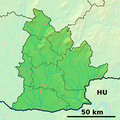
Fayl:Nitra Region - physical map.png

Sahifa kontenti boshqa tillarda dastaklanmaydi.
Vikipediya, ochiq ensiklopediya

Asl fayl(1 080 × 1 080 piksel, fayl hajmi: 3,34 MB, MIME tipi: image/png)

Ushbu fayl Vikiomborga yuklangan boʻlib, boshqa loyihalarda ham qoʻllanilishi mumkin. Uning tavsif sahifasidan olingan maʼlumot quyida keltirilgan.

Taʼrif

Background map of the Nitra Region, Slovakia, ready for the Geobox template, calibrated at en:Template:Geobox locator Nitra Region

Outline map of the Nitra Region, Slovakia, ready for the Geobox template, calibrated at en:Template:Geobox locator Nitra Region
Sanasi (UTC)
Manba
Muallif


This is a retouched picture, which means that it has been digitally altered from its original version. Modifications: fusion. The original can be viewed here: Nitra Region - outline map.svg. Modifications made by Adehertogh.

w:en:Creative Commons
atribut bir xil ulashish
Bu fayl Creative Commons asosida litsenziyalangan Attribution- Share Alike 3.0 Unported litsenziyasi.
Siz erkinsiz:
  • ulashishga – ishlanmani nusxalash, tarqatish va uzatish
  • remiks qilishga – ishni moslashtirishga
Quyidagi shartlar asosida:
  • atribut – Siz tegishli litsenziyaga havolani taqdim etishingiz va oʻzgartirishlar kiritilganligini koʻrsatishingiz kerak. Siz buni har qanday oqilona yoʻl bilan qilishingiz mumkin, lekin litsenziar Sizni yoki Sizning foydalanishingizni ma'qullashini taklif qiladigan tarzda emas.
  • bir xil ulashish – Agar Siz materialni remiks qilsangiz, oʻzgartirsangiz yoki unga asoslansangiz, oʻz hissalaringizni asl nusxadagi kabi bir xil yoki mos litsenziya ostida tarqatishingiz kerak.

Original upload log

This image is a derivative work of the following images:

  • File:Nitra_Region_-_background_map.png licensed with PD-Demis
    • 2007-10-27T18:13:21Z Caroig 1080x1080 (1111455 Bytes) Better alignment
    • 2007-10-27T13:52:04Z Caroig 1080x1080 (1117730 Bytes) == Summary == {{Information |Description=Background map of the Nitra Region, Slovakia, ready for the [[:en:Template:Geobox|Geobox]] template, calibrated at [[:en:Template:Geobox locator Nitra Region]] |Source=Made my myself f
  • File:Nitra_Region_-_outline_map.svg licensed with Cc-by-sa-3.0,2.5,2.0,1.0, GFDL
    • 2007-10-27T13:49:56Z Caroig 1350x1350 (127087 Bytes) == Summary == {{Information |Description=Outline map of the Nitra Region, Slovakia, ready for the [[:en:Template:Geobox|Geobox]] template, calibrated at [[:en:Template:Geobox locator Nitra Region]] |Source=self-made |Date=200

Uploaded with derivativeFX

Captions

Add a one-line explanation of what this file represents

Items portrayed in this file

tasvirlangan ob'ekt

Fayl tarixi

Faylning biror paytdagi holatini koʻrish uchun tegishli sana/vaqtga bosingiz.

Sana/VaqtMiniaturaOʻlchamlariFoydalanuvchiIzoh
joriy18:07, 19-Sentyabr 201018:07, 19-Sentyabr 2010 dagi versiya uchun tasvir1 080 × 1 080 (3,34 MB)Adehertogh{{Information |Description=Background map of the Nitra Region, Slovakia, ready for the Geobox template, calibrated at en:Template:Geobox locator Nitra Region Outline map of the Nitra Region, Slovakia, ready for the [[:en:Templ

Faylning global foydalanilishi