
Fayl:NZ Marlborough Sounds relief location map.svg

Size of this PNG preview of this SVG file: 452 × 599 piksel. Boshqa oʻlchamlari: 181 × 240 piksel | 362 × 480 piksel | 579 × 768 piksel | 773 × 1 024 piksel | 1 546 × 2 048 piksel | 2 600 × 3 445 piksel.
Asl fayl (SVG fayl, asl oʻlchamlari 2 600 × 3 445 piksel, fayl hajmi: 3,87 MB)
Qisqa izoh
| Taʼrif |
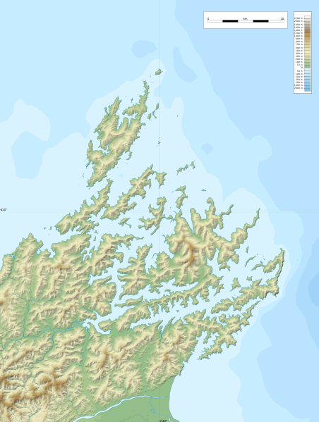
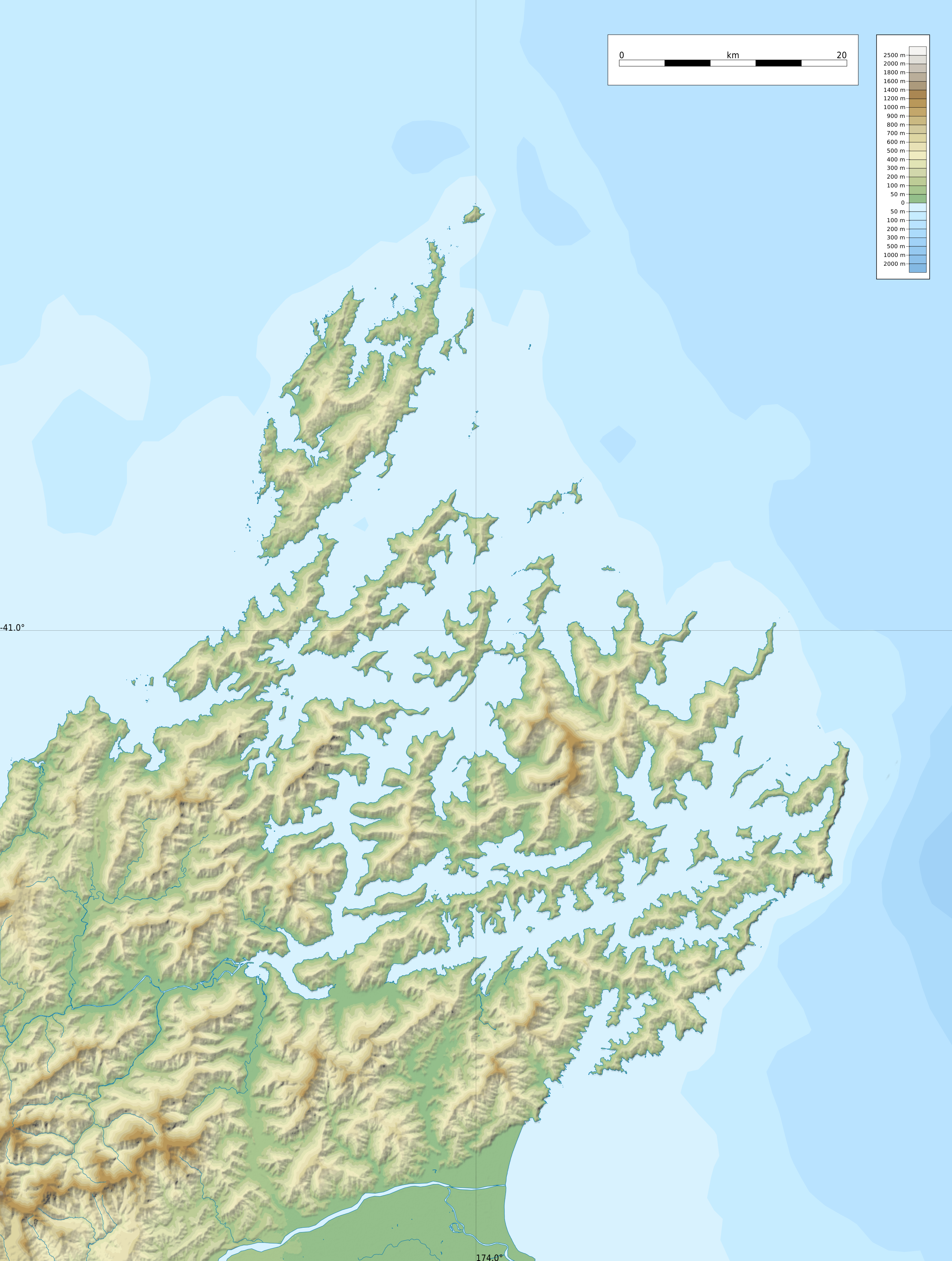
English: Relief location map of Marlborough Sounds, New Zealand
Geographic limits of the map:
|
| Sanasi | |
| Manba |
Oʻzimning ishim
|
| Muallif | ikonact |
Litsenziyalash
| This work contains information from OpenStreetMap, which is made available under the Open Database License (ODbL).
The ODbL does not require any particular license for maps produced from ODbL data. Prior to 1 August 2020, map tiles produced by the OpenStreetMap Foundation were licensed under the CC-BY-SA-2.0 license. Maps produced by other people may be subject to other licences. |
I, the copyright holder of this work, hereby publish it under the following license:
This file is licensed under the Creative Commons Attribution-Share Alike 4.0 International license.
- Siz erkinsiz:
- ulashishga – ishlanmani nusxalash, tarqatish va uzatish
- remiks qilishga – ishni moslashtirishga
- Quyidagi shartlar asosida:
- atribut – Siz tegishli litsenziyaga havolani taqdim etishingiz va oʻzgartirishlar kiritilganligini koʻrsatishingiz kerak. Siz buni har qanday oqilona yoʻl bilan qilishingiz mumkin, lekin litsenziar Sizni yoki Sizning foydalanishingizni ma'qullashini taklif qiladigan tarzda emas.
- bir xil ulashish – Agar Siz materialni remiks qilsangiz, oʻzgartirsangiz yoki unga asoslansangiz, oʻz hissalaringizni asl nusxadagi kabi bir xil yoki mos litsenziya ostida tarqatishingiz kerak.
Fayl tarixi
Faylning biror paytdagi holatini koʻrish uchun tegishli sana/vaqtga bosingiz.
| Sana/Vaqt | Miniatura | Oʻlchamlari | Foydalanuvchi | Izoh | |
|---|---|---|---|---|---|
| joriy | 22:55, 8-Fevral 2022 | | 2 600 × 3 445 (3,87 MB) | Ikonact | == {{int:filedesc}} == {{Information |description={{en|1=Relief location map of {{W|Marlborough Sounds}}, {{W|New Zealand}} Geographic limits of the map: * N: 40.5° S * S: 41.5° S * W: 173.5° E * E: 174.0° E}} |date=2022-02-08 |source={{own}} *Relief and bathymetry: Public domain SRTM3 and ETOPO1 *Coast: [https://data.linz.govt.nz/layer/105085-nz-coastline-mean-high-water/ Land Information New Zealand] © Creative Commons Attribution 4.0 International *Water bodies and rivers: © OpenStreetMap... |
Fayllarga ishoratlar
Bu faylga quyidagi 2 sahifalar bogʻlangan:
Faylning global foydalanilishi
Ushbu fayl quyidagi vikilarda ishlatilyapti:
- en.wikipedia.org loyihasida foydalanilishi
- Tory Channel
- Pelorus Sound
- Queen Charlotte Sound / Tōtaranui
- Cloudy Bay
- Maud Island
- Cape Jackson, New Zealand
- Port Underwood
- Linkwater
- Blumine Island
- Meretoto / Ship Cove
- Whatamangō Bay
- Lochmara Bay
- Module:Location map/data/New Zealand Marlborough Sounds
- Module:Location map/data/New Zealand Marlborough Sounds/doc
- Wikipedia:New Zealand Wikipedians' notice board/Archive 31
- Resolution Bay
- Endeavour Inlet
- fr.wikipedia.org loyihasida foydalanilishi
- Île d'Urville (Nouvelle-Zélande)
- The Brothers (Nouvelle-Zélande)
- Île de Maud
- Marlborough Sounds
- Phare de l'île Stephens
- Phare de Brothers Island
- Île Stephens
- French Pass
- Île Blumine
- Baie de Pelorus
- Baie de Tōtaranui
- Baie de Kenepuru
- Mont Stokes
- Île Arapaoa
- Canal de Tory
- Baie de Tennyson
- Te Whanganui
- Croisilles Harbour
- Baie de l'Amirauté (Nouvelle-Zélande)
- Modèle:Géolocalisation/Marlborough Sounds
- Modèle:Géolocalisation/Marlborough Sounds/Documentation
- Île Matapara
- Cap Soucis
- Île Motuara
- Long Island (Marlborough)
- Baie Anakoha
- Île Forsyth
- Îles Chetwode
- Port Gore
- si.wikipedia.org loyihasida foydalanilishi