
Fayl:NTRoads.png
Bu prevyuning hajmi: 493 × 599 piksel. Boshqa oʻlchamlari: 197 × 240 piksel | 395 × 480 piksel | 632 × 768 piksel | 842 × 1 024 piksel | 1 671 × 2 031 piksel.
Asl fayl (1 671 × 2 031 piksel, fayl hajmi: 379 KB, MIME tipi: image/png)
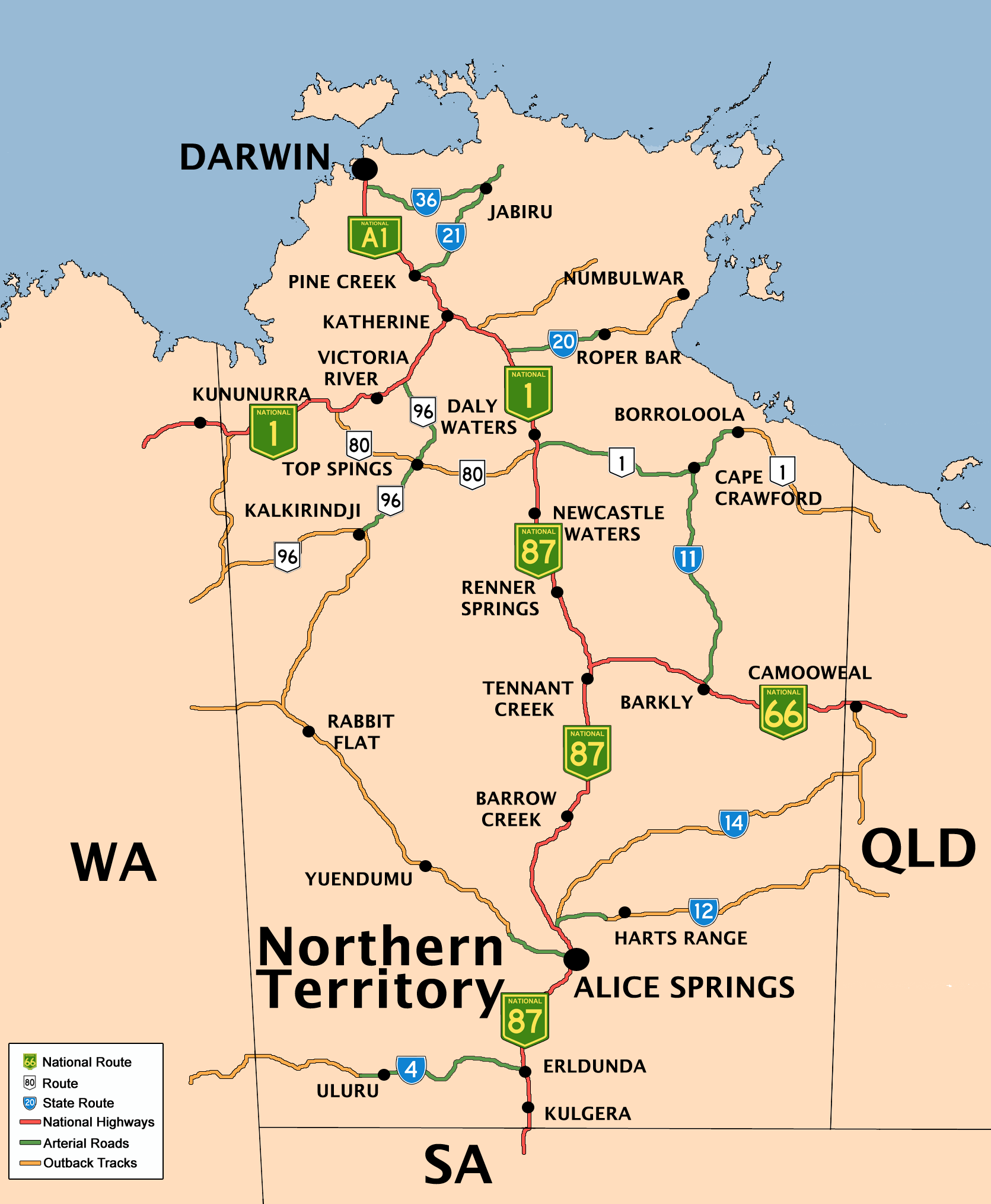
Qisqa izoh
| Taʼrif |
English: Created by Bidgee based upon on previous version by Mark and the previous version by Fikri. |
| Sanasi | 7 Dekabr 2004 (original upload date) |
| Manba | Transferred from en.wikipedia to Commons by Bidgee using CommonsHelper. |
| Muallif | The original uploader was Fikri at inglizcha Vikipediya. |
Litsenziyalash

|
Ushbu hujjatdan nusxa ko‘chirish, tarqatish va/yoki o‘zgartirish uchun GNU Erkin guvohnoma litsenziyasi (GNU Free Documentation License), 1.2 va har qanday keyingi versiyalar shartlariga muvofiq ruxsat berilgan yoki Ochiq kodli dasturlar jamiyati (Free Software Foundation) tomonidan chop etilgan; oʻzgarmas boʻlimlarsiz, oldingi muqova matnlari va orqa muqova matnlarisiz. Litsenziya nusxasi GNU Erkin guvohnoma litsenziyasi (GNU Free Documentation License) boʻlimiga kiritilgan. Subject to disclaimers. |
Original upload log
The original description page was here. All following user names refer to en.wikipedia.
- 2008-06-15 06:23 Bidgee 1671×2031×8 (387634 bytes) Reverted to version as of 06:06, 15 June 2008
- 2008-06-15 06:18 Rom rulz424 401×487×8 (114087 bytes) Reverted to version as of 05:51, 15 June 2008
- 2008-06-15 06:06 Bidgee 1671×2031×8 (387634 bytes) Fixed. Next time inform me of any changes so it can be done that way the high res image stays how it should be
- 2008-06-15 05:51 Rom rulz424 401×487×8 (114087 bytes) National Highway Route 87, terminates at Daly Waters, not Katherine as the previous map suggests. Route 1 is the only continuous route throughout Australia and can be proven that National Highway Route 1 turns off at Daly Waters along the Carpentaria High
- 2008-06-14 14:08 Bidgee 1671×2031×8 (382374 bytes) Fixed Routes 66 and 1. Darwin is A1
- 2008-06-14 13:14 Rom rulz424 493×599×8 (150852 bytes) Route 66 and 1 both required the "NATIONAL" shield. It may show on Google Maps that there are square with no alphanumeric symbol beside it, but no Australian route exists with a square and a number only inside in green. If you refer to other references l
- 2008-06-14 09:32 Bidgee 1671×2031×8 (360953 bytes) Update routes based on Google Maps
- 2008-05-19 15:40 Bidgee 1671×2031×8 (1793646 bytes) New version based on previous versions by Mark and Fikri.
- 2007-04-24 16:28 Mark 744×1052×8 (82741 bytes) New (beautified) version of the original map by [[User:Fikri]].
- 2004-12-10 10:19 Clarkk 760×1009×4 (18240 bytes) crop image
- 2004-12-07 09:35 Fikri 810×1080×4 (17298 bytes) {{GFDL}}
Fayl tarixi
Faylning biror paytdagi holatini koʻrish uchun tegishli sana/vaqtga bosingiz.
| Sana/Vaqt | Miniatura | Oʻlchamlari | Foydalanuvchi | Izoh | |
|---|---|---|---|---|---|
| joriy | 13:21, 14-Iyul 2008 | | 1 671 × 2 031 (379 KB) | Bidgee | {{Information |Description={{en|Created by Bidgee based upon on [http://upload.wikimedia.org/wikipedia/en/archive/3/32/20080519154026%21NTRoads.png previous version] by Mark and [http://upload.wikimedia.org/wikipedia/ |
Fayllarga ishoratlar
Bu faylga quyidagi 4 sahifalar bogʻlangan:
Faylning global foydalanilishi
Ushbu fayl quyidagi vikilarda ishlatilyapti:
- de.wikipedia.org loyihasida foydalanilishi
- de.wikivoyage.org loyihasida foydalanilishi
- en.wikipedia.org loyihasida foydalanilishi
- eo.wikipedia.org loyihasida foydalanilishi
- fr.wikipedia.org loyihasida foydalanilishi
- he.wikipedia.org loyihasida foydalanilishi
- he.wikivoyage.org loyihasida foydalanilishi
- hi.wikipedia.org loyihasida foydalanilishi
- it.wikipedia.org loyihasida foydalanilishi
- ja.wikipedia.org loyihasida foydalanilishi
- kn.wikipedia.org loyihasida foydalanilishi
- pl.wikipedia.org loyihasida foydalanilishi
- ru.wikipedia.org loyihasida foydalanilishi
- simple.wikipedia.org loyihasida foydalanilishi
- si.wikipedia.org loyihasida foydalanilishi
- vls.wikipedia.org loyihasida foydalanilishi