
Fayl:MulberryB - Piers.jpg
Bundan kattaroq tasvir yoʻq.
MulberryB_-_Piers.jpg (799 × 588 piksel, fayl hajmi: 184 KB, MIME tipi: image/jpeg)
Qisqa izoh
| Taʼrif |
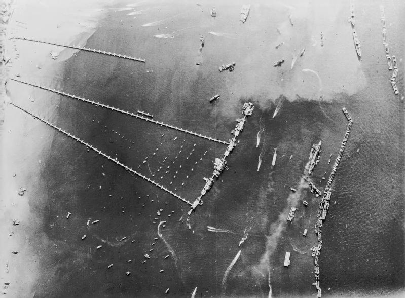
An aerial view of the pierhead and breakwater at the artificial 'Mulberry B Harbour' at Arromanches (Goosberry 3). |
|||
| Sanasi | ||||
| Manba |
|
|||
| Muallif | Royal Air Force official photographer | |||
| Other versions | ibiblio.org a collaboration of the centerforthepublicdomain.org |

| Camera location | | View this and other nearby images on: OpenStreetMap |
|---|
Litsenziyalash
This work created by the United Kingdom Government is in the public domain.
This is because it is one of the following:
HMSO has declared that the expiry of Crown Copyrights applies worldwide (ref: HMSO Email Reply)
|
 |
Fayl tarixi
Faylning biror paytdagi holatini koʻrish uchun tegishli sana/vaqtga bosingiz.
| Sana/Vaqt | Miniatura | Oʻlchamlari | Foydalanuvchi | Izoh | |
|---|---|---|---|---|---|
| joriy | 20:38, 18-Yanvar 2012 | | 799 × 588 (184 KB) | Cobatfor | IWM photo |
| 10:34, 31-May 2005 |  | 633 × 572 (75 KB) | W.wolny |
Fayllarga ishoratlar
Bu faylga quyidagi sahifa bogʻlangan:
Faylning global foydalanilishi
Ushbu fayl quyidagi vikilarda ishlatilyapti:
- azb.wikipedia.org loyihasida foydalanilishi
- cs.wikipedia.org loyihasida foydalanilishi
- de.wikipedia.org loyihasida foydalanilishi
- el.wikipedia.org loyihasida foydalanilishi
- en.wikipedia.org loyihasida foydalanilishi
- fa.wikipedia.org loyihasida foydalanilishi
- fr.wikipedia.org loyihasida foydalanilishi
- he.wikipedia.org loyihasida foydalanilishi
- ja.wikipedia.org loyihasida foydalanilishi
- la.wikipedia.org loyihasida foydalanilishi
- nl.wikipedia.org loyihasida foydalanilishi
- pl.wikipedia.org loyihasida foydalanilishi
- ro.wikipedia.org loyihasida foydalanilishi
- sr.wikipedia.org loyihasida foydalanilishi
- ta.wikipedia.org loyihasida foydalanilishi
- uk.wikipedia.org loyihasida foydalanilishi
- vi.wikipedia.org loyihasida foydalanilishi
- www.wikidata.org loyihasida foydalanilishi