
Fayl:Metro atlanta.jpg

Bu prevyuning hajmi: 570 × 599 piksel. Boshqa oʻlchamlari: 228 × 240 piksel | 456 × 480 piksel | 730 × 768 piksel | 1 025 × 1 078 piksel.
Asl fayl (1 025 × 1 078 piksel, fayl hajmi: 385 KB, MIME tipi: image/jpeg)

|
This map image could be re-created using vector graphics as an SVG file. This has several advantages; see Commons:Media for cleanup for more information. If an SVG form of this image is available, please upload it and afterwards replace this template with
{{vector version available|new image name}}.
It is recommended to name the SVG file “Metro atlanta.svg”—then the template Vector version available (or Vva) does not need the new image name parameter. |


Qisqa izoh
| Taʼrif |
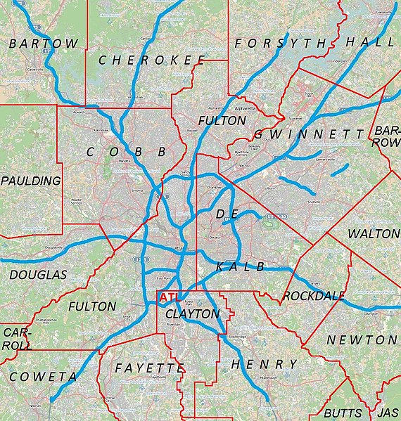
English: Metro Atlanta from Open Street Map |
| Sanasi | |
| Manba | Open street map |
| Muallif | Open street map |
Litsenziyalash
This file is licensed under the Creative Commons Attribution 2.5 Generic license.
- Siz erkinsiz:
- ulashishga – ishlanmani nusxalash, tarqatish va uzatish
- remiks qilishga – ishni moslashtirishga
- Quyidagi shartlar asosida:
- atribut – Siz tegishli litsenziyaga havolani taqdim etishingiz va oʻzgartirishlar kiritilganligini koʻrsatishingiz kerak. Siz buni har qanday oqilona yoʻl bilan qilishingiz mumkin, lekin litsenziar Sizni yoki Sizning foydalanishingizni ma'qullashini taklif qiladigan tarzda emas.
Fayl tarixi
Faylning biror paytdagi holatini koʻrish uchun tegishli sana/vaqtga bosingiz.
| Sana/Vaqt | Miniatura | Oʻlchamlari | Foydalanuvchi | Izoh | |
|---|---|---|---|---|---|
| joriy | 00:44, 18-Aprel 2011 | | 1 025 × 1 078 (385 KB) | Keizers | +county borders and airport |
| 17:22, 15-Aprel 2011 |  | 1 025 × 1 078 (571 KB) | Keizers | shows all counties now | |
| 17:38, 14-Aprel 2011 |  | 1 025 × 1 078 (548 KB) | Keizers | added thicker freeway lines and 3 key county names | |
| 15:16, 14-Aprel 2011 |  | 1 025 × 1 078 (362 KB) | Keizers | {{Information |Description ={{en|1=Metro Atlanta from Open Street Map}} |Source =Open street map |Author =Open street map |Date =2011-04-12 |Permission = |other_versions = }} Category:Atlanta maps |
Fayllarga ishoratlar
Bu faylga quyidagi 4 sahifalar bogʻlangan:
Faylning global foydalanilishi
Ushbu fayl quyidagi vikilarda ishlatilyapti:
- ar.wikipedia.org loyihasida foydalanilishi
- ban.wikipedia.org loyihasida foydalanilishi
- bcl.wikipedia.org loyihasida foydalanilishi
- bn.wikipedia.org loyihasida foydalanilishi
- ceb.wikipedia.org loyihasida foydalanilishi
- de.wikipedia.org loyihasida foydalanilishi
- en.wikipedia.org loyihasida foydalanilishi
- Cobb County, Georgia
- Canton, Georgia
- Holly Springs, Georgia
- Woodstock, Georgia
- College Park, Georgia
- Forest Park, Georgia
- Jonesboro, Georgia
- Austell, Georgia
- Kennesaw, Georgia
- Mableton, Georgia
- Marietta, Georgia
- Vinings, Georgia
- Newnan, Georgia
- Avondale Estates, Georgia
- Belvedere Park, Georgia
- Candler-McAfee, Georgia
- Chamblee, Georgia
- Decatur, Georgia
- Doraville, Georgia
- Lithonia, Georgia
- Panthersville, Georgia
- Scottdale, Georgia
- Stone Mountain, Georgia
- Douglasville, Georgia
- Cumming, Georgia
- Alpharetta, Georgia
- East Point, Georgia
- Fairburn, Georgia
- Roswell, Georgia
- Sandy Springs, Georgia
- Buford, Georgia
- Lawrenceville, Georgia
- Loganville, Georgia
- Norcross, Georgia
- Rest Haven, Georgia
- Snellville, Georgia
- Suwanee, Georgia
- Stockbridge, Georgia
- Covington, Georgia
- Dallas, Georgia
- Hiram, Georgia
Ushbu faylni koʻproq global foydalanishdan koʻring.