
Fayl:Luxembourg Grevenmacher location map.svg

Size of this PNG preview of this SVG file: 522 × 600 piksel. Boshqa oʻlchamlari: 209 × 240 piksel | 418 × 480 piksel | 669 × 768 piksel | 891 × 1 024 piksel | 1 783 × 2 048 piksel | 1 150 × 1 321 piksel.
Asl fayl (SVG fayl, asl oʻlchamlari 1 150 × 1 321 piksel, fayl hajmi: 267 KB)
Qisqa izoh
| Description |
|
|||||||||
| Sanasi | 1 September 2013 | |||||||||
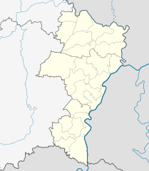
| Manba | You may find a page on the OpenStreetMap wiki page for Grevenmacher District | |||||||||
| Yaratuvchi |
NordNordWest
OpenStreetMap contributors |
|||||||||
| Ruxsat (Bu faylning takror foydalanilishi) |
OpenStreetMap data is available under the Open Database License (details). Map tiles are licensed under the Creative Commons Attribution-ShareAlike 2.0 license (CC-BY-SA 2.0).
This file is licensed under the Creative Commons Attribution-Share Alike 2.0 Generic license.
|
|||||||||
| Geotemporal data | ||||||||||
| Bounding box |
|
|||||||||
| Georeferencing | If inappropriate please set warp_status = skip to hide. | |||||||||
| Other versions | ||||||||||

|
This map has been made or improved in the German Kartenwerkstatt (Map Lab). You can propose maps to improve as well.
|
Fayl tarixi
Faylning biror paytdagi holatini koʻrish uchun tegishli sana/vaqtga bosingiz.
| Sana/Vaqt | Miniatura | Oʻlchamlari | Foydalanuvchi | Izoh | |
|---|---|---|---|---|---|
| joriy | 20:21, 1-Sentyabr 2013 | | 1 150 × 1 321 (267 KB) | NordNordWest | == {{int:filedesc}} == {{OpenStreetMap |name = Grevenmacher District |location = Grevenmacher District |description = {{de|Positionskarte für den Distrikt Grevenmacher, Luxemburg}}{{en|Locati... |
Fayllarga ishoratlar
Bu faylga quyidagi 2 sahifalar bogʻlangan:
Faylning global foydalanilishi
Ushbu fayl quyidagi vikilarda ishlatilyapti:
- ar.wikipedia.org loyihasida foydalanilishi
- ceb.wikipedia.org loyihasida foydalanilishi
- de.wikipedia.org loyihasida foydalanilishi
- en.wikipedia.org loyihasida foydalanilishi
- eo.wikipedia.org loyihasida foydalanilishi
- fa.wikipedia.org loyihasida foydalanilishi
- fr.wikipedia.org loyihasida foydalanilishi
- pl.wikipedia.org loyihasida foydalanilishi
- pl.wikibooks.org loyihasida foydalanilishi
- ru.wikipedia.org loyihasida foydalanilishi
- si.wikipedia.org loyihasida foydalanilishi
- war.wikipedia.org loyihasida foydalanilishi