
Fayl:Israel Sea Level BW 1.JPG
Bu prevyuning hajmi: 800 × 536 piksel. Boshqa oʻlchamlari: 320 × 214 piksel | 640 × 428 piksel | 1 024 × 685 piksel | 1 280 × 857 piksel | 2 560 × 1 714 piksel | 3 872 × 2 592 piksel.
Asl fayl (3 872 × 2 592 piksel, fayl hajmi: 2,88 MB, MIME tipi: image/jpeg)
Qisqa izoh
| Camera location | | View this and other nearby images on: OpenStreetMap |
|---|
| Taʼrif |
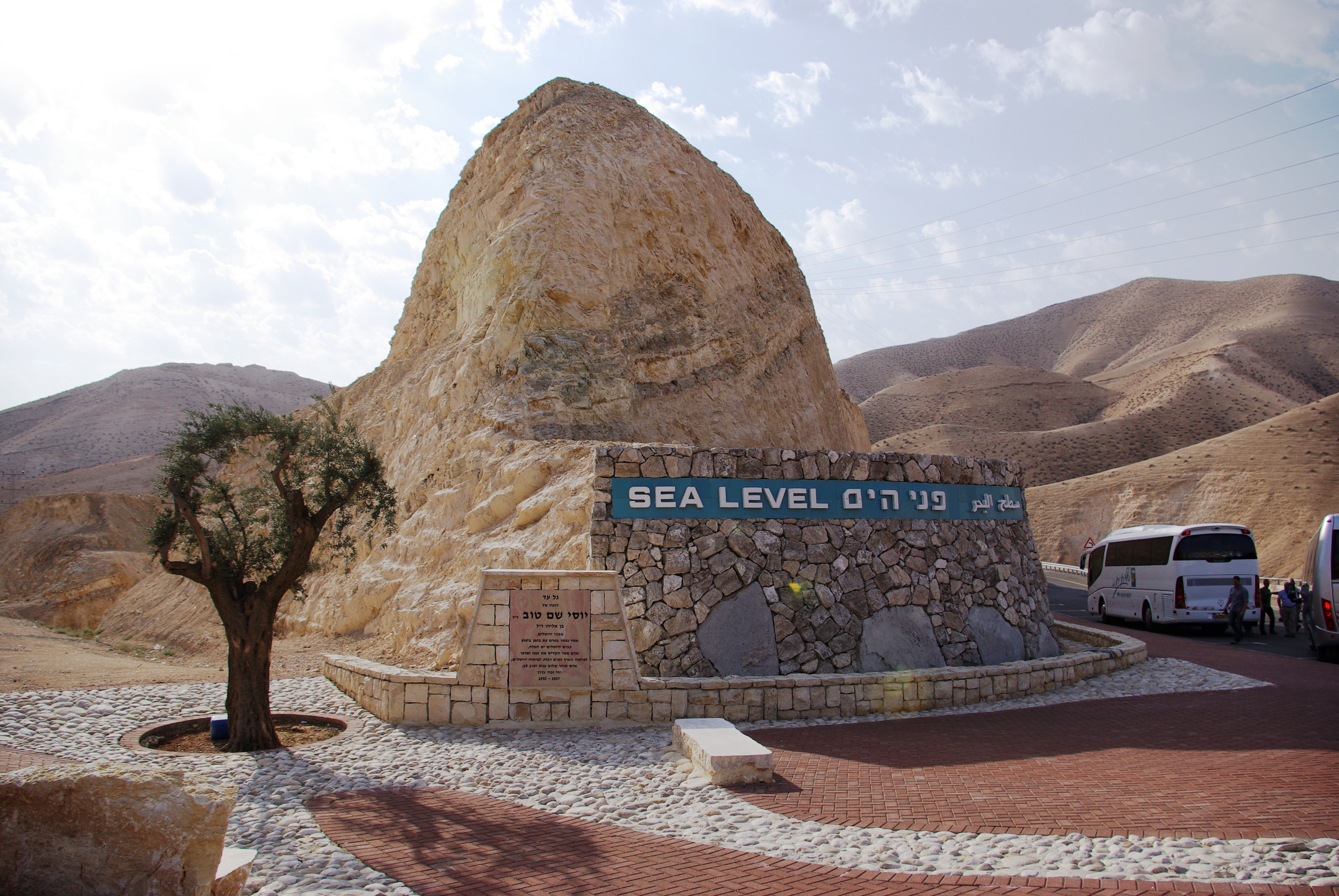
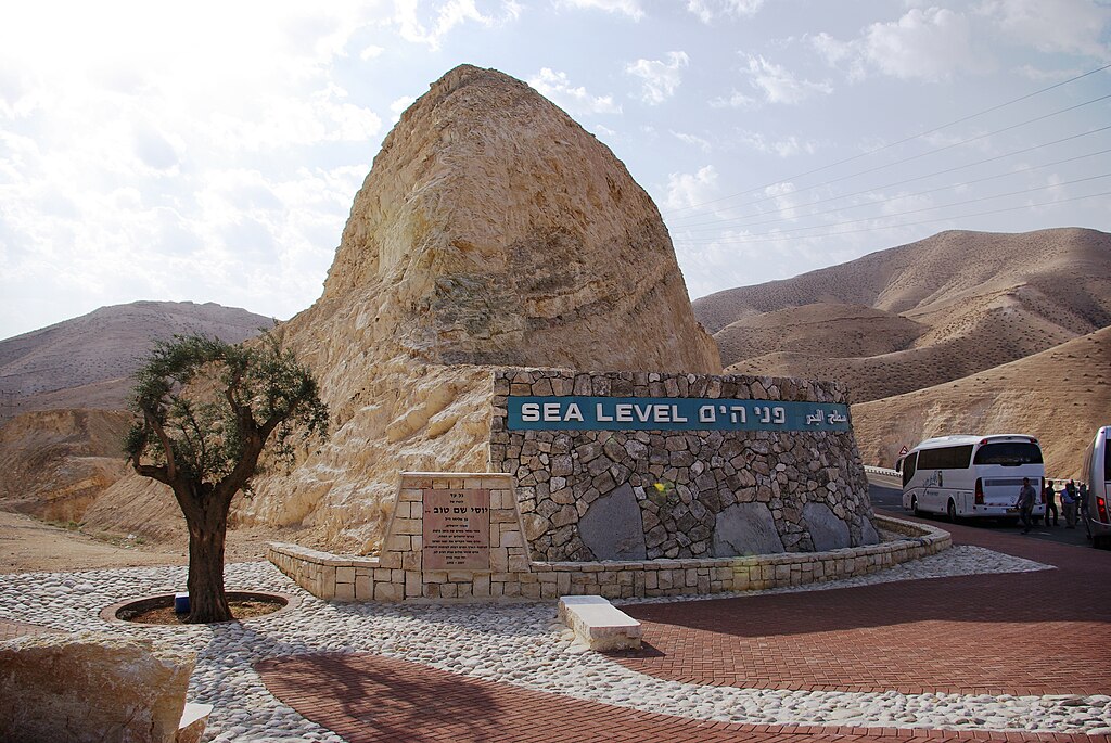
English: West Bank. Sea Level marker on the side of the road from Jerusalem to the Dead Sea
Deutsch: Westjordanland. Sea Level - Meereshöhe an der Straße von Jerusalem zum Toten Meer |
| Sanasi | |
| Manba | Oʻzimning ishim |
| Muallif | Berthold Werner |
Litsenziyalash
| I, the copyright holder of this work, release this work into the public domain. This applies worldwide. In some countries this may not be legally possible; if so: I grant anyone the right to use this work for any purpose, without any conditions, unless such conditions are required by law. |
Fayl tarixi
Faylning biror paytdagi holatini koʻrish uchun tegishli sana/vaqtga bosingiz.
| Sana/Vaqt | Miniatura | Oʻlchamlari | Foydalanuvchi | Izoh | |
|---|---|---|---|---|---|
| joriy | 16:40, 19-Fevral 2013 | | 3 872 × 2 592 (2,88 MB) | Soerfm | Contrast |
| 18:54, 24-Yanvar 2009 |  | 3 872 × 2 592 (2,72 MB) | Berthold Werner | {{Information |Description={{en|1=Israel. Sea Level at the street from Jerusalem to the Dead Sea}} {{de|1=Israel. Sea Level - Meereshöhe an der Straße von Jerusalem zum Toten Meer}} |Source=Eigenes Werk (own work) |Author=[[User:Berthold Werner|Berthold |
Fayllarga ishoratlar
Bu faylga quyidagi 2 sahifalar bogʻlangan:
Faylning global foydalanilishi
Ushbu fayl quyidagi vikilarda ishlatilyapti:
- af.wikipedia.org loyihasida foydalanilishi
- ar.wikipedia.org loyihasida foydalanilishi
- ast.wikipedia.org loyihasida foydalanilishi
- bn.wikipedia.org loyihasida foydalanilishi
- de.wikipedia.org loyihasida foydalanilishi
- en.wikipedia.org loyihasida foydalanilishi
- es.wikipedia.org loyihasida foydalanilishi
- et.wikipedia.org loyihasida foydalanilishi
- fa.wikipedia.org loyihasida foydalanilishi
- fr.wikipedia.org loyihasida foydalanilishi
- gu.wikipedia.org loyihasida foydalanilishi
- ha.wikipedia.org loyihasida foydalanilishi
- he.wikipedia.org loyihasida foydalanilishi
- hi.wikipedia.org loyihasida foydalanilishi
- ia.wikipedia.org loyihasida foydalanilishi
- ilo.wikipedia.org loyihasida foydalanilishi
- incubator.wikimedia.org loyihasida foydalanilishi
- io.wikipedia.org loyihasida foydalanilishi
- is.wikipedia.org loyihasida foydalanilishi
- ku.wikipedia.org loyihasida foydalanilishi
- mg.wikipedia.org loyihasida foydalanilishi
- mk.wikipedia.org loyihasida foydalanilishi
- mr.wikipedia.org loyihasida foydalanilishi
- my.wikipedia.org loyihasida foydalanilishi
- pms.wikipedia.org loyihasida foydalanilishi
- ro.wikipedia.org loyihasida foydalanilishi
- rue.wikipedia.org loyihasida foydalanilishi
- ru.wikipedia.org loyihasida foydalanilishi
- sk.wikipedia.org loyihasida foydalanilishi
- sl.wikipedia.org loyihasida foydalanilishi
- so.wikipedia.org loyihasida foydalanilishi
- sr.wikipedia.org loyihasida foydalanilishi
- tt.wikipedia.org loyihasida foydalanilishi
- uk.wikipedia.org loyihasida foydalanilishi
- ur.wikipedia.org loyihasida foydalanilishi
- vi.wikipedia.org loyihasida foydalanilishi
- war.wikipedia.org loyihasida foydalanilishi
- www.wikidata.org loyihasida foydalanilishi
- zh-min-nan.wikipedia.org loyihasida foydalanilishi