
Fayl:Ile de France.svg

Size of this PNG preview of this SVG file: 777 × 581 piksel. Boshqa oʻlchamlari: 320 × 239 piksel | 640 × 479 piksel | 1 024 × 766 piksel | 1 280 × 957 piksel | 2 560 × 1 914 piksel.
Asl fayl (SVG fayl, asl oʻlchamlari 777 × 581 piksel, fayl hajmi: 95 KB)
Qisqa izoh
| Taʼrif |
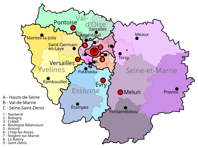
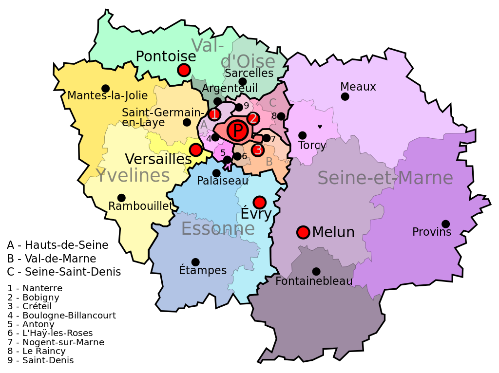
English: Île de France map
Español: Mapa de Île de France |
| Sanasi | |
| Manba | Oʻzimning ishim |
| Muallif | Jome |
| Camera location | | View this and other nearby images on: OpenStreetMap |
|---|
Litsenziyalash
| I, the copyright holder of this work, release this work into the public domain. This applies worldwide. In some countries this may not be legally possible; if so: I grant anyone the right to use this work for any purpose, without any conditions, unless such conditions are required by law. |
Fayl tarixi
Faylning biror paytdagi holatini koʻrish uchun tegishli sana/vaqtga bosingiz.
| Sana/Vaqt | Miniatura | Oʻlchamlari | Foydalanuvchi | Izoh | |
|---|---|---|---|---|---|
| joriy | 16:19, 9-Iyul 2011 | | 777 × 581 (95 KB) | AnonMoos | adjust margins |
| 15:32, 9-Iyul 2011 |  | 600 × 600 (96 KB) | Sémhur | Black Box Bug removed | |
| 08:48, 7-Iyun 2010 |  | 600 × 600 (112 KB) | Jome | {{Information |Description={{en|1=Île de France map}} {{es|1=Mapa de Île de France}} |Source={{own}} |Author=Jome |Date= |Permission= |other_versions= }} Category:Maps |
Fayllarga ishoratlar
Bu faylga quyidagi sahifa bogʻlangan:
Faylning global foydalanilishi
Ushbu fayl quyidagi vikilarda ishlatilyapti:
- bn.wikipedia.org loyihasida foydalanilishi
- el.wikipedia.org loyihasida foydalanilishi
- en.wikipedia.org loyihasida foydalanilishi
- fr.wikipedia.org loyihasida foydalanilishi
- Île-de-France
- Géographie de l'Île-de-France
- Modèle:Sommaire arrondissements de Paris
- Modèle:Infobox Voie de Paris
- Modèle:Géolocalisation/Paris
- Modèle:Carte/Paris
- Modèle:Infobox Voie de Paris/Documentation
- Modèle:Chronologie de Paris
- Wikipédia:Atelier graphique/Cartes/Archives/Demandes mises en sommeil/France
- Modèle:Infobox Porte de Paris
- Modèle:Infobox Porte de Paris/Documentation
- Modèle:Pays & territoires de naissance des Franciliens
- Modèle:Country data Paris
- Modèle:Tableau des superficies successives de Paris
- Modèle:Agglomération parisienne
- Modèle:Évolution de la population en Île-de-France
- Modèle:Courbe d'évolution de la population en Île-de-France
- Modèle:Évolution de la population de l'Île-de-France par département
- Modèle:Modèles liés Paris
- Modèle:Tableau Démographie Paris
- Modèle:Histogramme population Paris
- Modèle:Infobox Voie de Paris/Bac à sable
- id.wikipedia.org loyihasida foydalanilishi
- it.wikipedia.org loyihasida foydalanilishi
- lld.wikipedia.org loyihasida foydalanilishi
- mn.wikipedia.org loyihasida foydalanilishi
- vls.wikipedia.org loyihasida foydalanilishi