
Fayl:Canada relief map 2.svg

Size of this PNG preview of this SVG file: 709 × 600 piksel. Boshqa oʻlchamlari: 284 × 240 piksel | 568 × 480 piksel | 908 × 768 piksel | 1 211 × 1 024 piksel | 2 422 × 2 048 piksel | 1 114 × 942 piksel.
Asl fayl (SVG fayl, asl oʻlchamlari 1 114 × 942 piksel, fayl hajmi: 1,47 MB)
Qisqa izoh
| Taʼrif | |
| Sanasi | |
| Manba |
Oʻzimning ishim.
|
| Muallif | MapGrid |
| Other versions |
|
| SVG genesis |


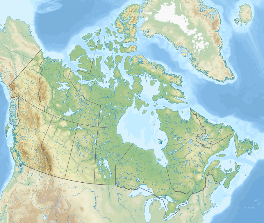
Map Info
| Projection: | Lambert conformal conic |
|---|---|
| Datum: | WGS84 |
| Central Meridian: | 95.000000°W |
| Latitude of Origin: | 60.000000°N |
| Standard Parallel #1: | 49.000000°N |
| Standard Parallel #2: | 77.000000°N |
| x (%)= | 201.7818903*(((tan(pi*(90-$1)/360))*(((1+0.08181919084*sin(pi*$1/180))/(1-0.08181919084*sin(pi*$1/180)))^0.04090959542))^0.9007900864)*sin(0.01572175288*($2+95))+43.98563734
|
|---|---|
| y (%)= | 238.6252927*(((tan(pi*(90-$1)/360))*(((1+0.08181919084*sin(pi*$1/180))/(1-0.08181919084*sin(pi*$1/180)))^0.04090959542))^0.9007900864)*cos(0.01572175288*($2+95))-15.81495465
|
| $1: | latitude in degrees (positive for all locations in Canada). |
| $2: | longitude in degrees (negative for all locations in Canada). |
| x (%): | x coordinate expressed as percentage of image width (measured from left edge). |
| y (%): | y coordinate expressed as percentage of image height (measured from top edge). |
| x (px) | y (px) | x (%) | y (%) | Latitude | Longitude | |
|---|---|---|---|---|---|---|
| Top Left Corner: | 0.000 | 0.000 | 0.00 | 0.00 | 68.220310°N | 176.138684°W |
| Top Right Corner: | 1114.000 | 0.000 | 100.00 | 0.00 | 62.238635°N | 9.994317°W |
| Bottom Right Corner: | 1114.000 | 942.000 | 100.00 | 100.00 | 34.831244°N | 61.953430°W |
| Bottom Left Corner: | 0.000 | 942.000 | 0.00 | 100.00 | 37.392537°N | 121.850536°W |
| Centre: | 557.000 | 471.000 | 50.00 | 50.00 | 63.068962°N | 88.152750°W |
| Origin: | 490.000 | 541.000 | 43.99 | 57.43 | 60.000000°N | 95.000000°W |
| North Pole: | 490.000 | -148.977 | 43.99 | -15.81 | 90.000000°N | ⸻ |
| Thechàl Dhâl: | 67.523 | 368.241 | 6.06 | 39.09 | 61.022873°N | 138.564925°W |
-R-121.85053574/37.39253661/-9.99431686/62.23863537r -JL-95.00000000/60.00000000/49.00000000/77.00000000/29.70666667i |
Litsenziyalash
I, the copyright holder of this work, hereby publish it under the following license:
This file is licensed under the Creative Commons Attribution-Share Alike 4.0 International license.
- Siz erkinsiz:
- ulashishga – ishlanmani nusxalash, tarqatish va uzatish
- remiks qilishga – ishni moslashtirishga
- Quyidagi shartlar asosida:
- atribut – Siz tegishli litsenziyaga havolani taqdim etishingiz va oʻzgartirishlar kiritilganligini koʻrsatishingiz kerak. Siz buni har qanday oqilona yoʻl bilan qilishingiz mumkin, lekin litsenziar Sizni yoki Sizning foydalanishingizni ma'qullashini taklif qiladigan tarzda emas.
- bir xil ulashish – Agar Siz materialni remiks qilsangiz, oʻzgartirsangiz yoki unga asoslansangiz, oʻz hissalaringizni asl nusxadagi kabi bir xil yoki mos litsenziya ostida tarqatishingiz kerak.
Fayl tarixi
Faylning biror paytdagi holatini koʻrish uchun tegishli sana/vaqtga bosingiz.
| Sana/Vaqt | Miniatura | Oʻlchamlari | Foydalanuvchi | Izoh | |
|---|---|---|---|---|---|
| joriy | 17:44, 29-Dekabr 2020 | | 1 114 × 942 (1,47 MB) | MapGrid | added an international boundary line between Canada and St Pierre & Miquelon |
| 19:03, 25-Dekabr 2020 |  | 1 114 × 942 (1,47 MB) | MapGrid | Christmas Day edition... more rivers | |
| 18:50, 15-Noyabr 2020 |  | 1 114 × 942 (1,47 MB) | MapGrid | Uploaded own work with UploadWizard |
Fayllarga ishoratlar
Bu faylga quyidagi 3 sahifalar bogʻlangan:
Faylning global foydalanilishi
Ushbu fayl quyidagi vikilarda ishlatilyapti:
- azb.wikipedia.org loyihasida foydalanilishi
- ban.wikipedia.org loyihasida foydalanilishi
- Taman Nasional Jasper
- Taman Nasional Banff
- Taman Nasional Glétsér (Kanada)
- Taman Nasional Cagar Palemahan Nahanni
- Taman Nasional miwah Cagar Palemahan Kluane
- Taman Nasional Wood Buffalo
- Taman Nasional Gros Morne
- Taman Nasional Aulavik
- Taman Nasional Auyuittuq
- Taman Nasional Grasslands
- Taman Nasional Cagar Palemahan Pagunungan Mealy
- Taman Nasional Samenanjung Bruce
- Taman Nasional Dataran Duur Cape Breton
- Taman Nasional Nusa Élk
- Taman Nasional Forillon
- Taman Nasional Kapuloan Celuk Georgian
- Taman Nasional Ivvavik
- Taman Nasional Cagar Palemahan Kapuloan Celuk
- Taman Nasional Cagar Palemahan Gwaii Haanas miwah Situs Tetamian Haida
- Taman Nasional Kootenay
- Taman Nasional Yoho
- Taman Nasional Sirmilik
- Taman Nasional Cagar Palemahan Lingkeh Pasifik
- Taman Nasional Danu Waterton
- Taman Nasional Cagar Palemahan Thaidene Nëné
- Taman Nasional Kejimkujik
- Taman Nasional La Mauricie
- Taman Nasional Cagar Palemahan Kapuloan Mingan
- Taman Nasional Gunung Revelstoke
- Taman Nasional Cagar Palemahan Náts'ihch'oh
- Taman Nasional Nusa Rajaputra Edward
- Taman Nasional Pukaskwa
- Taman Nasional Qausuittuq
- Taman Nasional Gunung Riding
- Taman Nasional Térra Nova
- Taman Nasional Thousand Islands
- Taman Nasional Pagunungan Torngat
- Taman Nasional Tuktut Nogait
- Lapangan BMO
- bg.wikipedia.org loyihasida foydalanilishi
Ushbu faylni koʻproq global foydalanishdan koʻring.