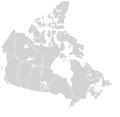
Fayl:Canada blank map.svg

Sahifa kontenti boshqa tillarda dastaklanmaydi.
Vikipediya, ochiq ensiklopediya

Asl fayl(SVG fayl, asl oʻlchamlari 1 114 × 942 piksel, fayl hajmi: 205 KB)

Ushbu fayl Vikiomborga yuklangan boʻlib, boshqa loyihalarda ham qoʻllanilishi mumkin. Uning tavsif sahifasidan olingan maʼlumot quyida keltirilgan.

Taʼrif
English: Blank SVG map of the territory claimed by Canada

Non-contiguous parts of a states/provinces are "grouped" together with the main area of the state/provinces, so any state/provinces can be coloured in completion with one click anywhere on the state/provinces's area.

Also, all states/provinces have a "id" attached to them, making them easy to find. Select "find" and then enter in the state/provinces's ISO 3166-2 code in the "id" field to find it. The codes can be found here.

There are 19 lakes shown; each has an ID that matches its official name. The lakes can be easily be found in the XML tree and they can be individually deleted to make room for text or other overlays.
Sanasi 03-07-2007 edited 8-Aug-2007
Manba
Muallif Lokal_Profil image cut to remove USA by Paul Robinson
Ruxsat
(Bu faylning takror foydalanilishi)
Public domain This map is ineligible for copyright and therefore in the public domain, because it consists entirely of information that is common property and contains no original authorship. For more information, see Commons:Threshold of originality § Maps.

English | Español | Galego | Română | slovenščina | العربية | 简体中文 | 繁體中文 | +/−

Other versions

Derivative works of this file:

Canada Labelled map.svg this map with province labels
Original blank map of USA and Canada, That image with labels,

Original USA/Canada map with labels
SVG genesis
InfoField
 
The SVG code is valid.
 
This map was created with Inkscape.

Captions

Add a one-line explanation of what this file represents

Items portrayed in this file

tasvirlangan ob'ekt

image/svg+xml

checksum inglizcha

3a165ea2ae3683659891b4c139a0f466e71efb69

determination method inglizcha: SHA-1 inglizcha

data size inglizcha

209 532 Bayt

width inglizcha

1 114 piksel

Fayl tarixi

Faylning biror paytdagi holatini koʻrish uchun tegishli sana/vaqtga bosingiz.

Sana/VaqtMiniaturaOʻlchamlariFoydalanuvchiIzoh
joriy23:30, 16-Noyabr 202023:30, 16-Noyabr 2020 dagi versiya uchun tasvir1 114 × 942 (205 KB)MapGridSync with File:Canada_location_map_2_-_lite.svg
11:43, 5-Dekabr 200711:43, 5-Dekabr 2007 dagi versiya uchun tasvir1 304 × 1 263 (113 KB)Lokal ProfilCleaned up code
21:25, 9-Avgust 200721:25, 9-Avgust 2007 dagi versiya uchun tasvir1 304 × 1 263 (115 KB)Rfc1394{{Information |Description={{en|Blank SVG map of Canada}} Non-contiguous parts of a states/provinces are "grouped" together with the main area of the state/provinces, so any state/provinces can be coloured in completion with one click anywhere on the stat

Bu faylga quyidagi 2 sahifalar bogʻlangan:

Faylning global foydalanilishi

Ushbu fayl quyidagi vikilarda ishlatilyapti:

Metama’lumot