
Fayl:CAN SK Swift Current map 2021.png

Bu prevyuning hajmi: 600 × 600 piksel. Boshqa oʻlchamlari: 240 × 240 piksel | 480 × 480 piksel | 768 × 768 piksel | 1 024 × 1 024 piksel | 1 300 × 1 300 piksel.
Asl fayl (1 300 × 1 300 piksel, fayl hajmi: 456 KB, MIME tipi: image/png)
Qisqa izoh
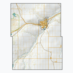
| Taʼrif | A series of maps of Saskatchewan rural municipalities, using open CEC Landsat-derived land cover data (2015) to generate a naturalistic colour scheme. Generalized hillshade created with my own proprietary algorithm. Vector features from Saskatchewan's ISC, the Government of Canada, and some manual digitization of urban footprints and abandoned railways. Made with QGIS. |
| Sanasi | |
| Manba | Oʻzimning ishim |
| Muallif | awmcphee |
Litsenziyalash
I, the copyright holder of this work, hereby publish it under the following license:
| This file is made available under the Creative Commons CC0 1.0 Universal Public Domain Dedication. | |
| The person who associated a work with this deed has dedicated the work to the public domain by waiving all of their rights to the work worldwide under copyright law, including all related and neighboring rights, to the extent allowed by law. You can copy, modify, distribute and perform the work, even for commercial purposes, all without asking permission.
|
Fayl tarixi
Faylning biror paytdagi holatini koʻrish uchun tegishli sana/vaqtga bosingiz.
| Sana/Vaqt | Miniatura | Oʻlchamlari | Foydalanuvchi | Izoh | |
|---|---|---|---|---|---|
| joriy | 16:15, 9-Iyul 2021 | | 1 300 × 1 300 (456 KB) | Awmcphee |
Fayllarga ishoratlar
Bu faylga quyidagi 2 sahifalar bogʻlangan:
Faylning global foydalanilishi
Ushbu fayl quyidagi vikilarda ishlatilyapti:
- en.wikipedia.org loyihasida foydalanilishi
- si.wikipedia.org loyihasida foydalanilishi