
Fayl:Bratislava Region - physical map.png

Bu prevyuning hajmi: 494 × 600 piksel. Boshqa oʻlchamlari: 198 × 240 piksel | 560 × 680 piksel.
Asl fayl (560 × 680 piksel, fayl hajmi: 1,09 MB, MIME tipi: image/png)
| Taʼrif |
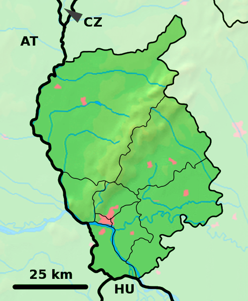
Background map of the Bratislava Region, Slovakia, ready for the Geobox template, calibrated at en:Template:Geobox locator Bratislava Region Outline map of the Bratislava Region, Slovakia, ready for the Geobox template, calibrated at en:Template:Geobox locator Bratislava Region |
| Sanasi | (UTC) |
| Manba | |
| Muallif |
|
| This is a retouched picture, which means that it has been digitally altered from its original version. Modifications: fusion. The original can be viewed here: Bratislava Region - outline map.svg:
|
Bu fayl Creative Commons asosida litsenziyalangan Attribution- Share Alike 3.0 Unported litsenziyasi.
- Siz erkinsiz:
- ulashishga – ishlanmani nusxalash, tarqatish va uzatish
- remiks qilishga – ishni moslashtirishga
- Quyidagi shartlar asosida:
- atribut – Siz tegishli litsenziyaga havolani taqdim etishingiz va oʻzgartirishlar kiritilganligini koʻrsatishingiz kerak. Siz buni har qanday oqilona yoʻl bilan qilishingiz mumkin, lekin litsenziar Sizni yoki Sizning foydalanishingizni ma'qullashini taklif qiladigan tarzda emas.
- bir xil ulashish – Agar Siz materialni remiks qilsangiz, oʻzgartirsangiz yoki unga asoslansangiz, oʻz hissalaringizni asl nusxadagi kabi bir xil yoki mos litsenziya ostida tarqatishingiz kerak.
Original upload log
This image is a derivative work of the following images:
- File:Bratislava_Region_-_background_map.png licensed with PD-Demis
- 2007-10-28T23:14:11Z Caroig 560x680 (333118 Bytes) fixing alignment
- 2007-10-27T19:44:14Z Caroig 560x680 (335827 Bytes) == Summary == {{Information |Description=Background map of the Bratislava Region, Slovakia, ready for the [[:en:Template:Geobox|Geobox]] template, calibrated at [[:en:Template:Geobox locator Bratislava Region]] |Source=Made m
- File:Bratislava_Region_-_outline_map.svg licensed with Cc-by-sa-3.0,2.5,2.0,1.0, GFDL
- 2007-10-27T19:47:14Z Caroig 700x850 (120252 Bytes) == Summary == {{Information |Description=Outline map of the Bratislava Region, Slovakia, ready for the [[:en:Template:Geobox|Geobox]] template, calibrated at [[:en:Template:Geobox locator Bratislava Region]] |Source=self-made
Uploaded with derivativeFX
Fayl tarixi
Faylning biror paytdagi holatini koʻrish uchun tegishli sana/vaqtga bosingiz.
| Sana/Vaqt | Miniatura | Oʻlchamlari | Foydalanuvchi | Izoh | |
|---|---|---|---|---|---|
| joriy | 18:01, 19-Sentyabr 2010 | | 560 × 680 (1,09 MB) | Adehertogh | {{Information |Description=Background map of the Bratislava Region, Slovakia, ready for the Geobox template, calibrated at en:Template:Geobox locator Bratislava Region Outline map of the Bratislava Region, Slovakia, ready for |
Fayllarga ishoratlar
Bu faylga quyidagi 2 sahifalar bogʻlangan:
Faylning global foydalanilishi
Ushbu fayl quyidagi vikilarda ishlatilyapti:
- bg.wikipedia.org loyihasida foydalanilishi
- en.wikipedia.org loyihasida foydalanilishi
- Pezinok
- Gajary
- Malacky
- Petržalka
- Modra
- Svätý Jur
- Dunajská Lužná
- Senec, Slovakia
- Vysoká pri Morave
- Jakubov
- Kostolište
- Suchohrad
- Jablonové, Malacky District
- Pernek
- Kuchyňa
- Rusovce
- Jarovce
- Blatné
- Rohožník, Malacky District
- Borinka
- Zohor
- Láb
- Lozorno
- Marianka
- Plavecké Podhradie
- Plavecký Mikuláš
- Plavecký Štvrtok
- Sološnica
- Studienka
- Veľké Leváre
- Závod, Slovakia
- Budmerice
- Báhoň
- Doľany, Pezinok District
- Dubová, Pezinok District
- Jablonec, Pezinok District
- Slovenský Grob
- Vinosady
- Limbach, Slovakia
- Viničné
- Vištuk
- Štefanová, Pezinok District
- Šenkvice
- Častá
- Bernolákovo
- Boldog, Slovakia
Ushbu faylni koʻproq global foydalanishdan koʻring.