
Fayl:Aisne department location map.svg

Size of this PNG preview of this SVG file: 404 × 599 piksel. Boshqa oʻlchamlari: 162 × 240 piksel | 323 × 480 piksel | 518 × 768 piksel | 690 × 1 024 piksel | 1 381 × 2 048 piksel | 1 124 × 1 667 piksel.
Asl fayl (SVG fayl, asl oʻlchamlari 1 124 × 1 667 piksel, fayl hajmi: 399 KB)
Qisqa izoh
| Camera location | | View this and other nearby images on: OpenStreetMap |
|---|
| Taʼrif |
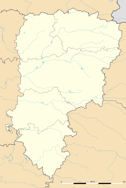
English: Blank administrative map of the department of Aisne, France, as in January 2015, for geo-location purpose, with distinct boundaries for regions, departments and arrondissements.
Français : Carte administrative vierge du département de l'Aisne, France, tel qu'en janvier 2015, destinée à la géolocalisation, avec limite distincte des régions, départements et arrondissements. Estimated scale: 1:360,000 (precision: 90 m)
Geographic limits of the map:
|
||
| Sanasi | |||
| Manba |
Oʻzimning ishim
|
||
| Muallif | Eric Gaba (Sting - fr:Sting) | ||
| Ruxsat (Bu faylning takror foydalanilishi) |
|
||
| Other versions |
|

Litsenziyalash
Eric Gaba, Wikimedia Commons user Sting, the copyright holder of this work, hereby publishes it under the following license:
Bu fayl Creative Commons asosida litsenziyalangan Attribution- Share Alike 3.0 Unported litsenziyasi.
Attributsiya: Eric Gaba, Wikimedia Commons user Sting
- Siz erkinsiz:
- ulashishga – ishlanmani nusxalash, tarqatish va uzatish
- remiks qilishga – ishni moslashtirishga
- Quyidagi shartlar asosida:
- atribut – Siz tegishli litsenziyaga havolani taqdim etishingiz va oʻzgartirishlar kiritilganligini koʻrsatishingiz kerak. Siz buni har qanday oqilona yoʻl bilan qilishingiz mumkin, lekin litsenziar Sizni yoki Sizning foydalanishingizni ma'qullashini taklif qiladigan tarzda emas.
- bir xil ulashish – Agar Siz materialni remiks qilsangiz, oʻzgartirsangiz yoki unga asoslansangiz, oʻz hissalaringizni asl nusxadagi kabi bir xil yoki mos litsenziya ostida tarqatishingiz kerak.
Fayl tarixi
Faylning biror paytdagi holatini koʻrish uchun tegishli sana/vaqtga bosingiz.
| Sana/Vaqt | Miniatura | Oʻlchamlari | Foydalanuvchi | Izoh | |
|---|---|---|---|---|---|
| joriy | 17:05, 12-Yanvar 2015 | | 1 124 × 1 667 (399 KB) | Sting | == {{int:filedesc}} == {{Location|49|27|00|N|03|36|00|E|scale:500000}} {{Information |Description={{en|Blank administrative map of the department of Aisne, France, as in January 2015, for geo-location purpose, with distinct boundaries for... |
Fayllarga ishoratlar
Bu faylga quyidagi 2 sahifalar bogʻlangan:
Faylning global foydalanilishi
Ushbu fayl quyidagi vikilarda ishlatilyapti:
- als.wikipedia.org loyihasida foydalanilishi
- de.wikipedia.org loyihasida foydalanilishi
- en.wikipedia.org loyihasida foydalanilishi
- eo.wikipedia.org loyihasida foydalanilishi
- Villers-Cotterêts
- Vermand
- Château-Thierry
- Laon
- Saint-Quentin (Aisne)
- Soissons
- Vervins
- Beaurevoir
- Marly-Gomont
- Chézy-sur-Marne
- La Ferté-Milon
- Nogent-l'Artaud
- Charly-sur-Marne
- Bazoches-sur-Vesles
- Tergnier
- Ŝablono:Situo sur mapo Francio Aisne
- Saint-Quentin (stacidomo)
- Quierzy
- Laon (stacidomo)
- Soissons (stacidomo)
- Hirson (stacidomo)
- Hirson
- Vervins (stacidomo)
- Villers-Cotterêts (stacidomo)
- Longpont (stacidomo)
- Longpont
- Hirson-Écoles (stacidomo)
- Vierzy (stacidomo)
- Vierzy
- Versigny (stacidomo)
- Versigny (Aisne)
- Vaumoise (stacidomo)
- Coyolles
- Vauxaillon (stacidomo)
- Vauxaillon
- Verneuil-sur-Serre (stacidomo)
- Verneuil-sur-Serre
- Viry-Noureuil (stacidomo)
- Viry-Noureuil
- Fère-en-Tardenois (stacidomo)
- Fère-en-Tardenois
Ushbu faylni koʻproq global foydalanishdan koʻring.