
Fayl:Steven & Elizabeth Archibald Farmstead Tangent.jpg

Bu prevyuning hajmi: 800 × 600 piksel. Boshqa oʻlchamlari: 320 × 240 piksel | 640 × 480 piksel | 1 024 × 768 piksel | 1 280 × 960 piksel | 2 304 × 1 728 piksel.
Asl fayl (2 304 × 1 728 piksel, fayl hajmi: 770 KB, MIME tipi: image/jpeg)
|
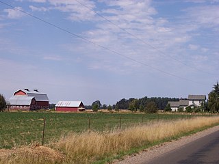
This is an image of a place or building that is listed on the National Register of Historic Places in the United States of America. Its reference number is 4001068. |
Qisqa izoh
Steven & Elizabeth Archibald Farmstead. Located south of Tangent, Oregon. Listed in the National Register of Historic Places.
Litsenziyalash
| I, the copyright holder of this work, release this work into the public domain. This applies worldwide. In some countries this may not be legally possible; if so: I grant anyone the right to use this work for any purpose, without any conditions, unless such conditions are required by law. |
| Object location | | View this and other nearby images on: OpenStreetMap |
|---|
Fayl tarixi
Faylning biror paytdagi holatini koʻrish uchun tegishli sana/vaqtga bosingiz.
| Sana/Vaqt | Miniatura | Oʻlchamlari | Foydalanuvchi | Izoh | |
|---|---|---|---|---|---|
| joriy | 00:12, 21-Avgust 2009 | | 2 304 × 1 728 (770 KB) | 46percent | Steven & Elizabeth Archibald Farmstead. Located south of Tangent, Oregon. Listed in the National Register of Historic Places. |
Fayllarga ishoratlar
Bu faylga quyidagi sahifa bogʻlangan:
Faylning global foydalanilishi
Ushbu fayl quyidagi vikilarda ishlatilyapti:
- ar.wikipedia.org loyihasida foydalanilishi
- bg.wikipedia.org loyihasida foydalanilishi
- ceb.wikipedia.org loyihasida foydalanilishi
- ce.wikipedia.org loyihasida foydalanilishi
- cy.wikipedia.org loyihasida foydalanilishi
- en.wikipedia.org loyihasida foydalanilishi
- es.wikipedia.org loyihasida foydalanilishi
- eu.wikipedia.org loyihasida foydalanilishi
- fr.wikipedia.org loyihasida foydalanilishi
- ht.wikipedia.org loyihasida foydalanilishi
- hu.wikipedia.org loyihasida foydalanilishi
- it.wikipedia.org loyihasida foydalanilishi
- ky.wikipedia.org loyihasida foydalanilishi
- lld.wikipedia.org loyihasida foydalanilishi
- pl.wikipedia.org loyihasida foydalanilishi
- pt.wikipedia.org loyihasida foydalanilishi
- sr.wikipedia.org loyihasida foydalanilishi
- tt.wikipedia.org loyihasida foydalanilishi
- uk.wikipedia.org loyihasida foydalanilishi
- www.wikidata.org loyihasida foydalanilishi