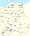
Fayl:Rzeczpospolita 1937.svg

Sahifa kontenti boshqa tillarda dastaklanmaydi.
Vikipediya, ochiq ensiklopediya

Asl fayl(SVG fayl, asl oʻlchamlari 2 220 × 1 554 piksel, fayl hajmi: 573 KB)

Ushbu fayl Vikiomborga yuklangan boʻlib, boshqa loyihalarda ham qoʻllanilishi mumkin. Uning tavsif sahifasidan olingan maʼlumot quyida keltirilgan.

Qisqa izoh

Taʼrif Test version of a vectorized File:Rzeczpospolita 1920.png; more changes will follow, only checking if wiki displays it right
Sanasi
Manba

Oʻzimning ishim; based on an earlier raster map made in 2005, as well as similar maps made by myself in 2004 (see below).
In preparation of this map I used many other maps as sources and backup. Among them were:

  • a German roadmap of Poland printed in 1938 (colours and the shape of East Prussian border)
  • and perhaps a dozen others.
Muallif Halibutt
Other versions
SVG genesis
InfoField
 
The source code of this SVG is invalid due to 2 errors.
 
This W3C-invalid map was created with Adobe Illustrator,
 
and with Inkscape.
 
 This map uses embedded text that can be easily translated using a text editor.


Copyright notice: Image made by Halibutt and uploaded to Wikipedia by the author. Images can be made available for use under other copyleft licenses on a case by case basis via direct contact with the author. Under moral rights the user requires that this work be properly attributed to its creator. For photographs, this is traditionally done in the image caption. Where a copyright notice is present, using the copyright notice in the caption will be sufficient. Note that the GFDL requires that any copyright notices be included with the work even when making unmodified use of it.

Since the legal status of the above comment has been questioned, I hereby grant anyone the right to treat it as either a standard copyright notice, invariant section, legal statement, legal advice, friendly suggestion or a mere comment, depending on his or hers own choice.
Halibutt
GNU head Ushbu hujjatdan nusxa ko‘chirish, tarqatish va/yoki o‘zgartirish uchun GNU Erkin guvohnoma litsenziyasi (GNU Free Documentation License), 1.2 va har qanday keyingi versiyalar shartlariga muvofiq ruxsat berilgan yoki Ochiq kodli dasturlar jamiyati (Free Software Foundation) tomonidan chop etilgan; oʻzgarmas boʻlimlarsiz, oldingi muqova matnlari va orqa muqova matnlarisiz. Litsenziya nusxasi GNU Erkin guvohnoma litsenziyasi (GNU Free Documentation License) boʻlimiga kiritilgan.
w:en:Creative Commons
atribut bir xil ulashish
Bu fayl Creative Commons asosida litsenziyalangan Attribution- Share Alike 3.0 Unported litsenziyasi.
Siz erkinsiz:
  • ulashishga – ishlanmani nusxalash, tarqatish va uzatish
  • remiks qilishga – ishni moslashtirishga
Quyidagi shartlar asosida:
  • atribut – Siz tegishli litsenziyaga havolani taqdim etishingiz va oʻzgartirishlar kiritilganligini koʻrsatishingiz kerak. Siz buni har qanday oqilona yoʻl bilan qilishingiz mumkin, lekin litsenziar Sizni yoki Sizning foydalanishingizni ma'qullashini taklif qiladigan tarzda emas.
  • bir xil ulashish – Agar Siz materialni remiks qilsangiz, oʻzgartirsangiz yoki unga asoslansangiz, oʻz hissalaringizni asl nusxadagi kabi bir xil yoki mos litsenziya ostida tarqatishingiz kerak.
This licensing tag was added to this file as part of the GFDL licensing update.

The following is a list of maps created by Halibutt and uploaded to commons, as well as their present and projected derivatives.

Parent Image Image Description
  Maps by Halibutt
Image:Rzeczpospolita.png Image:Rzeczpospolita.png The Republic in 17th and 18th century
Image:Rzeczpospolita 1600.png The Republic after the Treaty of Dywilino
Image:Rzeczpospolita voivodships.png Voivodships of The Republic
Image:Rzeczpospolita_Potop.png The Republic during The Deluge and Chmielnicki Uprising, with major battles of the era marked
Magnates and their lands and domains
1st2nd3rd Partitions of Poland
War of the constitution
Image:Rzeczpospolita.xcf SOURCE FILE - GIMP format
Image:Poland 1939.png Image:Poland 1939.png Poland in 1939
Image:Dywizje wrzesien 1.png Order of Battle on September 1st, during the Polish Defence War of 1939
Image:Poland 1939.xcf SOURCE FILE - GIMP format
Image:Polska kontur bialy.png Image:Polska kontur bialy.png Contour map of Poland AD 1999, for use with various locator maps
Image:Rzeczpospolita 1923.png Image:Rzeczpospolita 1923.png Map of Poland 1918-1939, currently under development
Image:PBW March 1919.png Polish-Bolshevik War - fronts in March of 1919
Image:PBW December 1919.png Polish-Bolshevik War - fronts in December of 1919
Image:PBW June 1920.png Polish-Bolshevik War - fronts in July of 1920
Image:PBW August 1920.png Polish-Bolshevik War - fronts in August of 1920
Polish Defence War of 1939
Polish areas annexed by Germany, Lithuania, Slovakia and the Soviet Union
German concentration camps in Poland
Curzon line
Major battles of the Polish-Bolshevik War
namesno names Polish/Czechoslovak/Lithuanian/German/Ukrainian claims in 1920's
Image:Rzeczpospolita Central Lithuania.png Central Lithuania
Image:Rzeczpospolita Lithuania claims.png Central Lithuania as compared with other Lithuanian claims
Image:Rzeczpospolita 1789-1920.png Post-1922 borders compared with the territory of Poland before the partitions
Warsaw Uprising and the Operation Tempest
Poland partitioned between the Soviets and the Germans
Image:Rzeczpospolita 1939 Polish divisions.png Polish divisions on September 1, 1939
Home Army inspectorates
Image:Rzeczpospolita 1922.xcf SOURCE FILE - GIMP format
Image:Rzeczpospolita 1937.svg Vector version!!!! layered version available on request

Captions

Add a one-line explanation of what this file represents

Items portrayed in this file

tasvirlangan ob'ekt

11 Mart 2008

Fayl tarixi

Faylning biror paytdagi holatini koʻrish uchun tegishli sana/vaqtga bosingiz.

(eng yangi | eng eski) Koʻrib chiqish (yangiroq 10 | ) (10 | 20 | 50 | 100 | 250 | 500)
Sana/VaqtMiniaturaOʻlchamlariFoydalanuvchiIzoh
joriy15:24, 1-Yanvar 201715:24, 1-Yanvar 2017 dagi versiya uchun tasvir2 220 × 1 554 (573 KB)Sascha GPDMalmö (duplicate) -> Göteborg
14:34, 30-Iyul 201314:34, 30-Iyul 2013 dagi versiya uchun tasvir2 220 × 1 554 (573 KB)HalibuttAdded some rivers in Russia, corrected others (RO, HU, PL)
03:28, 30-Iyul 201303:28, 30-Iyul 2013 dagi versiya uchun tasvir2 220 × 1 563 (458 KB)HalibuttSweden corrected (town names added)
03:16, 30-Iyul 201303:16, 30-Iyul 2013 dagi versiya uchun tasvir2 214 × 1 567 (492 KB)Halibuttcrunched version (deleted background layers)
03:13, 30-Iyul 201303:13, 30-Iyul 2013 dagi versiya uchun tasvir2 214 × 1 567 (3,68 MB)Halibuttlet's see if the expanded version works
18:11, 16-Iyul 201018:11, 16-Iyul 2010 dagi versiya uchun tasvir2 014 × 1 567 (534 KB)HierakaresCorrected position of name Oppeln which was overlapping with point.
08:54, 14-Mart 200808:54, 14-Mart 2008 dagi versiya uchun tasvir2 014 × 1 567 (534 KB)HalibuttNames of larger towns enlarged
08:45, 14-Mart 200808:45, 14-Mart 2008 dagi versiya uchun tasvir2 014 × 1 567 (533 KB)Halibuttversion corrected by Madman
00:30, 14-Mart 200800:30, 14-Mart 2008 dagi versiya uchun tasvir2 000 × 1 534 (512 KB)Halibutt{{Information |Description= |Source=self-made |Date= |Author= Halibutt |Permission= |other_versions= }}
23:54, 13-Mart 200823:54, 13-Mart 2008 dagi versiya uchun tasvir2 000 × 1 534 (548 KB)Halibutt{{Information |Description= |Source=self-made |Date= |Author= Halibutt |Permission= |other_versions= }}
(eng yangi | eng eski) Koʻrib chiqish (yangiroq 10 | ) (10 | 20 | 50 | 100 | 250 | 500)

Bu faylga quyidagi sahifa bogʻlangan:

Faylning global foydalanilishi

Ushbu fayl quyidagi vikilarda ishlatilyapti:

Ushbu faylni koʻproq global foydalanishdan koʻring.

Metama’lumot