
Fayl:Txu-pclmaps-oclc-22834566 g-8b.jpg

Bu prevyuning hajmi: 800 × 599 piksel. Boshqa oʻlchamlari: 320 × 240 piksel | 640 × 479 piksel | 1 024 × 767 piksel | 1 280 × 959 piksel | 2 560 × 1 917 piksel | 9 596 × 7 187 piksel.
Asl fayl (9 596 × 7 187 piksel, fayl hajmi: 23,54 MB, MIME tipi: image/jpeg)
Qisqa izoh
| Taʼrif |
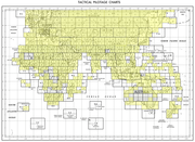
English: Tactical Pilotage Chart Series - World 1:500,000 Scale |
| Sanasi | |
| Manba | |
| Muallif | Defense Mapping Agency |
-
 Index Map

Litsenziyalash
This work is in the public domain in the United States because it is a work prepared by an officer or employee of the United States Government as part of that person’s official duties under the terms of Title 17, Chapter 1, Section 105 of the US Code.
Note: This only applies to original works of the Federal Government and not to the work of any individual U.S. state, territory, commonwealth, county, municipality, or any other subdivision. This template also does not apply to postage stamp designs published by the United States Postal Service since 1978. (See § 313.6(C)(1) of Compendium of U.S. Copyright Office Practices). It also does not apply to certain US coins; see The US Mint Terms of Use.
|
 | |
| This file has been identified as being free of known restrictions under copyright law, including all related and neighboring rights. | ||
Fayl tarixi
Faylning biror paytdagi holatini koʻrish uchun tegishli sana/vaqtga bosingiz.
| Sana/Vaqt | Miniatura | Oʻlchamlari | Foydalanuvchi | Izoh | |
|---|---|---|---|---|---|
| joriy | 12:10, 27-Dekabr 2019 | | 9 596 × 7 187 (23,54 MB) | Geographyinitiative | User created page with UploadWizard |
Fayllarga ishoratlar
Bu faylga quyidagi sahifa bogʻlangan:
Faylning global foydalanilishi
Ushbu fayl quyidagi vikilarda ishlatilyapti:
- ca.wikipedia.org loyihasida foydalanilishi
- en.wikipedia.org loyihasida foydalanilishi
- en.wiktionary.org loyihasida foydalanilishi
- es.wikipedia.org loyihasida foydalanilishi
- ja.wikipedia.org loyihasida foydalanilishi
- pa.wikipedia.org loyihasida foydalanilishi
- pt.wikipedia.org loyihasida foydalanilishi
- ro.wikipedia.org loyihasida foydalanilishi
- sl.wikipedia.org loyihasida foydalanilishi
- sr.wikipedia.org loyihasida foydalanilishi
- te.wikipedia.org loyihasida foydalanilishi