
Fayl:Irma 2017-09-05 1706Z.jpg
Bu prevyuning hajmi: 450 × 600 piksel. Boshqa oʻlchamlari: 180 × 240 piksel | 360 × 480 piksel | 576 × 768 piksel | 768 × 1 024 piksel | 1 536 × 2 048 piksel | 4 950 × 6 600 piksel.
Asl fayl (4 950 × 6 600 piksel, fayl hajmi: 8,39 MB, MIME tipi: image/jpeg)
Qisqa izoh
| Taʼrif |
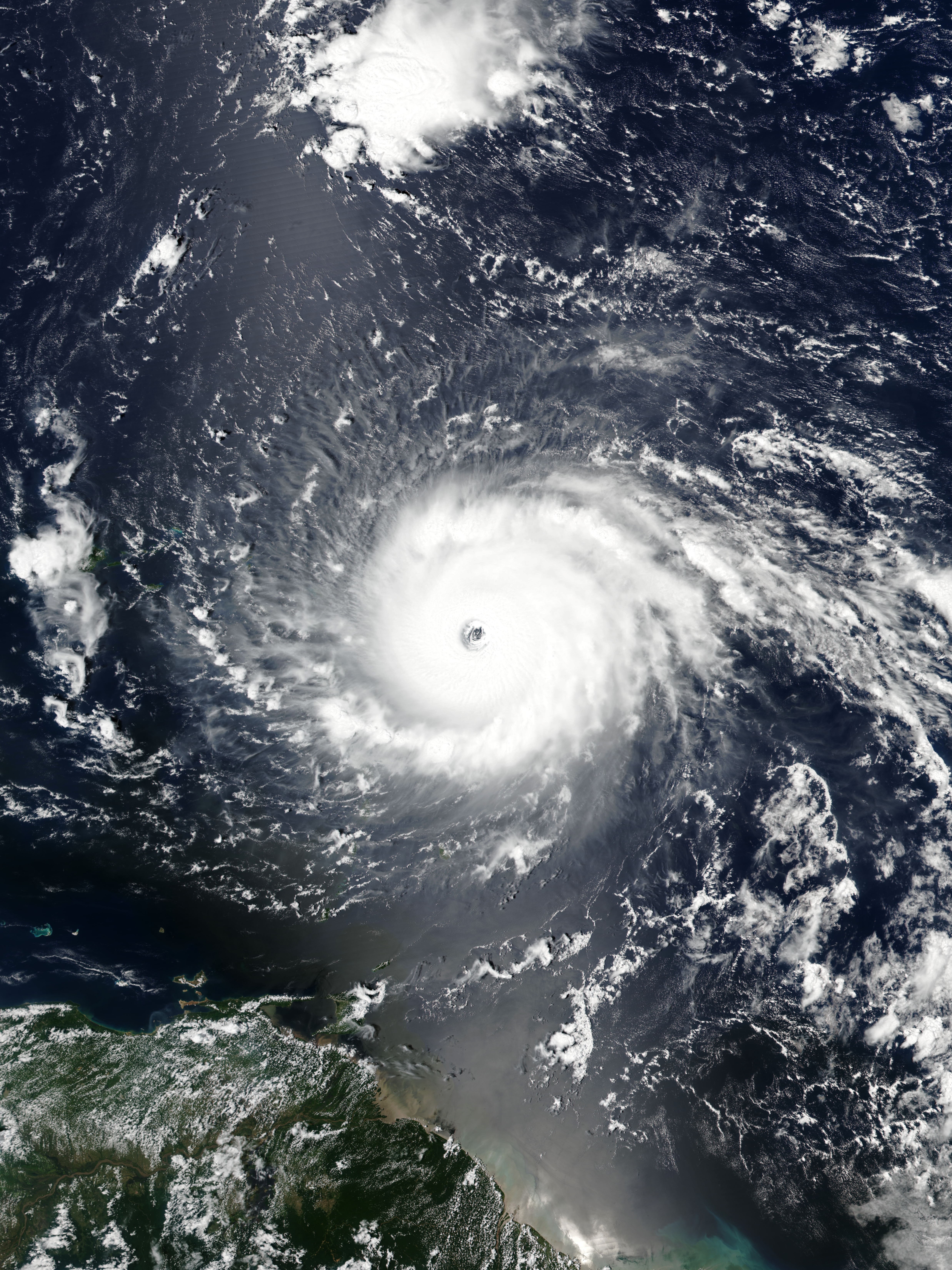
English: Hurricane Irma approaching the Leeward Islands at peak intensity on September 5, 2017 as the third most intense Atlantic hurricane on record in terms of sustained winds. |
| Sanasi | |
| Manba | EOSDIS Worldview |
| Muallif | VIIRS image captured by NOAA’s Suomi NPP satellite |
| Camera location | | View this and other nearby images on: OpenStreetMap |
|---|
Litsenziyalash
| This file is in the public domain in the United States because it was solely created by NASA. NASA copyright policy states that "NASA material is not protected by copyright unless noted". (See Template:PD-USGov, NASA copyright policy page or JPL Image Use Policy.) | ||
 |
Warnings:
|
Fayl tarixi
Faylning biror paytdagi holatini koʻrish uchun tegishli sana/vaqtga bosingiz.
| Sana/Vaqt | Miniatura | Oʻlchamlari | Foydalanuvchi | Izoh | |
|---|---|---|---|---|---|
| joriy | 01:21, 15-May 2021 | | 4 950 × 6 600 (8,39 MB) | Supportstorm | Reverted to version as of 21:19, 5 September 2017 (UTC) |
| 00:12, 15-May 2021 |  | 437 × 452 (89 KB) | Super Cyclonic Storm Corona | Crop a bit. | |
| 21:19, 5-Sentyabr 2017 |  | 4 950 × 6 600 (8,39 MB) | Meow | User created page with UploadWizard |
Fayllarga ishoratlar
Bu faylga quyidagi 3 sahifalar bogʻlangan:
Faylning global foydalanilishi
Ushbu fayl quyidagi vikilarda ishlatilyapti:
- ca.wikipedia.org loyihasida foydalanilishi
- cs.wikipedia.org loyihasida foydalanilishi
- en.wikipedia.org loyihasida foydalanilishi
- Portal:Tropical cyclones/Anniversaries/September
- Portal:Tropical cyclones/Anniversaries/September/5
- User:LightandDark2000/My Notable Storms
- Talk:Hurricane Irma/Archive 2
- User:Tfmbty/List of the most intense tropical cyclones since 1979
- User talk:36.82.216.113
- Talk:2018 Atlantic hurricane season/Archive 2
- User talk:82.8.147.67
- es.wikipedia.org loyihasida foydalanilishi
- et.wikipedia.org loyihasida foydalanilishi
- eu.wikipedia.org loyihasida foydalanilishi
- ga.wikipedia.org loyihasida foydalanilishi
- hu.wikipedia.org loyihasida foydalanilishi
- hy.wikipedia.org loyihasida foydalanilishi
- pt.wikipedia.org loyihasida foydalanilishi
- ru.wikipedia.org loyihasida foydalanilishi
- sd.wikipedia.org loyihasida foydalanilishi
- sr.wikipedia.org loyihasida foydalanilishi
- th.wikipedia.org loyihasida foydalanilishi
- uk.wikipedia.org loyihasida foydalanilishi
- www.wikidata.org loyihasida foydalanilishi
- zh.wikipedia.org loyihasida foydalanilishi